|
||

|

|
|

|
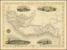
An intriguing relic of 19th-century commercial colonialism, the Outline Map of Part of the West Coast of Africa Shewing the Company's Stations, printed by Donnison & Son, offers a unique glimpse into the operations of the Commercial Company of Africa, Limited, during the mid-19th century. The map, marked by the company's stations along the west African coast, provides an insight into the trade network established by the company during its relatively brief period of operation.
In the mid-1860s to the mid-1870s, the period in which historical references to the Commercial Company of Africa are most frequent, the corporation appears to have conducted a trade network along the Bights of Benin and Biafra, the River Niger, and other parts of Africa. The company traded European manufactured goods for a variety of African products such as palm oil, palm-nut kernels, ground nuts, gold dust, ivory, cotton, and more. This map, therefore, symbolizes the extensive economic interactions between Africa and Europe during this era.
The Outline Map of Part of the West Coast of Africa clearly distinguishes the British settlements and the company's stations in red and blue, respectively, providing an understanding of their geographical extent. The locations mentioned—Monrovia, Cape Palmas, and the Bight of Benin Stations: Porto Novo, Badagry, Lagos, Palma, and Leckie—underlines the company's broad geographic reach during its operation. Moreover, the detailed palm oil districts demarcated by the representation of palm trees further contribute to the map's detailing.
The map, drawn and printed in London, is a testament to the proficiency of 19th-century British cartography. Its precision, reflected in the clear demarcation of settlements and trade stations, helps to contextualize the scale and organization of the Commercial Company of Africa's trading activities. In this sense, the artifact offers valuable insights into the historical processes of trade and commerce between Europe and Africa during the Victorian era, making it a significant reference point for researchers and scholars of economic and colonial history.
![X. b [Congo]](https://storage.googleapis.com/raremaps/img/small/93299.jpg)