


|
||

|

|
|

|
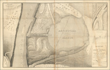
Detailed and very interesting original antique folding map of central Canada, showing the region between Manitoba and the foot of the Rocky Mountains, with an inset showing the region between Manitoba and the Great Lakes. The map was issued in 1881 in Toronto as part of Belden's Illustrated Atlas Of The Dominion Of Canada.
The map is highly detailed, showing topography, rivers, watersheds, cities, and much more. Tracts that have been surveyed near Winnipeg are shown. Routes of explorers, including those of the Mounted Police Force in 1874, are shown.
Settling The Canadian West
The map explicitly focuses on the Canada Pacific Railway. It was incorporated in 1881 as part of Canada's promise to British Columbia that, if it joined the Dominion, a railroad would connect it to the rest of the country. On the map, dashed lines show possible tracks that the railway would take. The railway was particularly instrumental in the settling of the Canadian interior.
The CPR was nearly completed in 1885 when the northwest Rebellion, led by Louis Riel, broke out between Métis and First Nations groups and the Canadian government. The rebellion stretched over what is now Saskatchewan and Alberta. After the Cree war party attacked a white settlement at Frog Lake, Canadian militia from Ontario were sent to the District of Alberta via the CPR and fought against the rebels. The rebels were defeated at Batoche, Saskatchewan.
After the 1885 Northwest Rebellion was put down, settlers began to pour into Alberta. The closing of the American frontier around 1890 led 600,000 Americans to move to Saskatchewan and Alberta, where the farming frontier flourished between 1897–1914.
The railways developed town sites six to ten miles apart and lumber companies and speculators loaned money to encourage building on the lots. Immigrants faced an unfamiliar, harsh environment. Building a home, clearing and cultivating thirty acres, and fencing the entire property, all of which were requirements of homesteaders seeking title to their new land, were difficult tasks in the glacier-carved valleys.
Initially, the government preferred English-speaking settlers from Eastern Canada or Great Britain and to a lesser extent, the United States. However, in order to speed up the rate of settlement, the government under the direction of Minister of the Interior Clifford Sifton soon began advertising to attract settlers from continental Europe. Large numbers of Germans, Ukrainians, and Scandinavians moved in, among others, often coalescing into distinct ethnic settlement blocks, giving parts of Alberta distinctive ethnic clusters.
![[French America and the Triangular Trade] L'Amérique Françoise Où son Décrites La France Nouvelle, La France Insulaire, La France Equinoctiale, et autre pais Par P. Du Val d'Abbeville Geographe du Roy . . .](https://storage.googleapis.com/raremaps/img/small/91968.jpg)
![(Inuit Self Portrait) [Original watercolor of George Niagungitok] George Niakungitok, Esquimaux, Indian, price 6d, Drawn by Himself [mounted in:] The White Peninsula, A Journey in Russian Lapland and Karelia by Edward Rae.](https://storage.googleapis.com/raremaps/img/small/94266.jpg)
![Carta rappresentante una parte della Baja Hudson, e le Regioni a Maestro dell'America Settentrle. [Map representing a part of Hudson Bay, and the regions to the northwest of North America.]](https://storage.googleapis.com/raremaps/img/small/95989.jpg)
![[ Polar Regions ] Pais qui Dependent de la Norvege Suivant les Derniers Relations Par N. de Fer.](https://storage.googleapis.com/raremaps/img/small/100688.jpg)
![(Photograph album) America | Hawaii. 1885. [Photographic album of Hawaii, Yellowstone, Utah, Colorado, and Niagara Falls]](https://storage.googleapis.com/raremaps/img/small/87949.jpg)