|
||

|

|
|

|
Rare plan of the Holy Land and Jersualem, published in Paris in 1641.
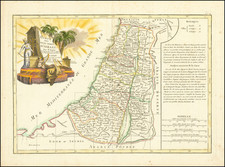
The lower map shows Palestine as the land of the 12 tribes on both sides of the Jordan, oriented with the east to the top and "Mare Magnum" to the bottom.
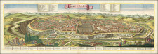
At the top left is a map of ancient Syria, "Syriae veteris descriptio," showing the Eastern Mediterranean and the Near East, drawn from the Roman period. At the center is a map of Ancient Jerusalem, also drawn from the Roman period.
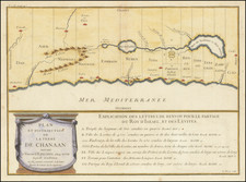
At the far top right is a map of showing the Exodus from Egypt and wanderings of the Tribes from Ramses in Egypt through the Red Sea and the Sinai Peninsula until they reached Palestine, based on the Old Testament.
The map was published originally in a three volume historical atlas, Parellela geographie veteris et novae, 1641-1649 written by the Jesuit Priest Philip Briet. This example bears the imprint of Michel van Lochem and was separately published. Another state, bearing the imprint of Pierre Mariette is more commonly seen. The Van Lochom state is very rare.
![De Gelegentheyt van't Paradys en't Landt Canaan mitsgaders d'eerst bewoonde Landen der Patriachen uyt de H. Schristure …[Shows Cyprus]](https://storage.googleapis.com/raremaps/img/small/82746.jpg)
![[Tribe of Zebulon] Zebulon ad Portum Marium Ipse ad Portu Marium Habitabit](https://storage.googleapis.com/raremaps/img/small/85057.jpg)
![(Czech Edition) Tabule zemj, fragin a mest/w nichz G. Paivael fazal [Bunting's Map of the Eastern Mediterranean Region]](https://storage.googleapis.com/raremaps/img/small/93467.jpg)