|
||

|

|
|

|
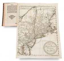
Presentation Copy of The Premier Map of the Period (Rumsey) from the Golden Age of American Cartography
First edition of H.S. Tanner's map of the United States, first published in 1829.
Tanner's map is a fascinating amalgam of early territories and districts in the Upper Midwest. Michigan Territory is shown, with counties and settlements only in the southeastern portion of the state, although a blank squares on the Kalamazoo River portends the future settlement of Kalamazoo and a number of early roads read the southwestern part of the Territory. A road traverses the southern part of the Territory, extending to Chicago and Fort Dearborn.
A massive Huron District (more or less Wisconsin, eastern Minnesota and a portion of Canada to the North) and Sioux District (the future Iowa Territory, comprising parts of the future states of Iowa, western Minnesota, the Dakotas and a portion of Canada). Further west are the Mandan, Osage and Ozark Districts, overlaid with many of the major Indian Tribes relocated from the Southeast over the prior decades.
The US-Canadian boundary extends to the Lake of the Woods, with an annotation noting the Treaty of 1818 and the significance of the 49th Parallel. The map predates the boundary changes set forth in the1831 boundary as settled through arbitration by William I, King of Holland.
Includes nice detail along the Missouri River, naming Fort Mandan and numerous Indian tribes, with their populations noted. The map also locates the routes and portages between lakes, the American Fur Co., and numerous trading posts.
The map is bounded at the sides with 14 large city plans and a chart of the "South Part of Florida." The plans include the cities of New Orleans, Charleston, Cincinnati, two of New York City, Boston, Albany, Baltimore, Philadelphia, Pittsburgh, and Washington D.C., which contains a floor plan of the Capitol building. Above the main map is a large inset "Oregon and Mandan Districts" that contains a small inset "Outlet of Oregon River" which names Astoria.
At the bottom left, there are a large group of Railroad and Canal profiles.
Provenance
The present example bears an inscription "James P. Stabler to Captn. R.R. Crocker" below the cartouche. James P. Stabler (1796–1840) was a chief engineer for two of the earliest railroads in the United States, the Baltimore & Ohio Railroad and the the Wilmington & Susquehanna Railroad. Captain Rowland Robinson Crocker (1770-1852) was a whaleman, privateer, merchant captain and Liverpool packet commander, who served as a state representative. He lived quite an interesting life. A musket ball went through one side of his body and out the other. He shook Napoleons hand, was captured by the French and was rewarded by Lloyd’s for navigating a wreck The Otis through a gale in 1807.
![Charte von Den Vereinigten Staaten von Nord-America nebst Louisiana . . . 1805 [Rare 1st State of Gussefeld's Louisiana Purchase Map]](https://storage.googleapis.com/raremaps/img/small/63496.jpg)
![[Shows Republic of Texas] United States and Texas](https://storage.googleapis.com/raremaps/img/small/101139.jpg)