


|
||

|

|
|

|
"In Ireland, the map possesses the same pioneer status as is held in England and Wales by William Smith's map..." - Gordon L. Davies
With Provenance to Sir Edward Cooper Hodge, the Commander of the Irish 4th Dragoon Guards at the Charge of the Heavy Brigade.
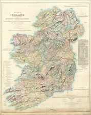
A handsome example of Richard Giffith's masterwork, the first large-scale geological map of Ireland, published in Dublin in 1839.
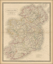
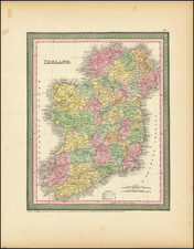
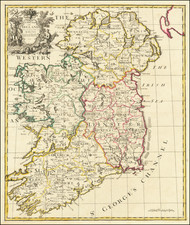
This enormous six-sheet map was produced for the national Railway Commission and shows the magnificent base topography of Ireland at the impressive quarter-inch-to-the-mile scale. The map represents the culmination of a quarter-century of labor by Richard Griffith, a key figure in mid-19th century Ireland, who it was said was involved in every major public works project of the time.
This example appears to predate the standard practice of coloring the geological strata. While it is clearly configured to allow for such coloring, and examples from these earlier editions surely exist with geological coloring, all examples that we have traced that do have the geological coloring are from the 1855 edition. As such, here the image is in stark black-and-white to focus on the geography and early railroads of the country. The detail is extraordinary, with topography, towns, loughs, roads, and much more shown throughout the country at a resolution of several hundred yards. Mines are marked on the map, including gold, iron, copper, lead, coal, and antimony diggings. Off the west coast of the country are additional key boxes that could be hand-colored. Below this cartouche, a facsimile of Griffith's signature is dated "Dublin March 28 1839," a matter of contention for the map (discussed further below). Below the map, an uncolored cross-section appears, and an extensive legend of non-geological features is printed in the lower right.
Griffith and the Early Geological Mapping of Ireland
The Griffith map has been the subject of extensive research. Griffith first had a manuscript geological map of the entire island sometime around 1815, when he first referred to a manuscript map in one of his lectures. It is known that made many editions of this manuscript map, slowly coloring in portions of the country as he and other geologists mapped ever-increasing portions of the island. However, it was thought that all examples of Griffith's manuscript maps were lost until the recent discovery of an annotated Alexander Taylor map appeared in the archives of the Geological Society.
A printed map by Griffith would have to wait until 1838 when he published the first geological map of Ireland at a scale reduced from the present (1 inch to 10 miles). This map accompanied a railroad report which he was also involved in. In 1839, the enlarged and significantly more detailed version of his map appeared, which remained in circulation until 1855 as the foremost authority on the geology of the country.
Griffith retained the 1839 dating on the map despite continuously updating the map with the work of other researchers. This practice drew criticism at the time as some felt that this practice suggested that he, in fact, discovered the newly-depicted elements first. Perhaps to assuage this criticism, a member of the Irish Ordnance Survey (usually James Duncan) would date the map in the lower right of each sheet. In addition, Griffith would sometimes change the date on the map himself when presenting to a scientific audience likely to know that the work on the map was not exclusively his own.
Provenance
The slipcase is embossed with the name Major Hodge, 4th Dragoon Guards. Sir Edward Cooper Hodge (1810-1894) was a commander of the 4th Royal Irish Regiment of Dragoon Guards during the Crimean War. He distinguished himself at the Battle of Balaclava (1854), where he was promoted to command of the 5th Dragoon Guards, and would be later promoted to General.
Rarity
The map is scarce. Only nine examples are listed in OCLC.
![Ireland in Provinces and Counties [with] County Map of Scotland](https://storage.googleapis.com/raremaps/img/small/78014.jpg)