


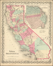
|
||

|

|
|

|
A Post Earthquake Boom Town South of San Francisco -- Shows Uncle Tom's Cabin!
Rare map and promotional brochure for Huntington Park, promoted by Tucker Company, with an early reference to the iconic San Bruno roadhouse Uncle Tom's Cabin.
Huntington Park was first promoted in the fall of 1907 and by 1908 was a successfully completed project, fueled by the demand for places to live south of San Francisco after the 1906 earthquake. The promotional text was compelling, but certainly the demand for living quarters south of the city was in escapable.
On the verso are more photos and promotional text, along with a rendering of a "New Type Suburban Car", the Huntington Flier -- 15 minutes to San Francisco for a 5 cents.
The map shows the location of Uncle Tom's Cabin, the iconic Road House at the foot of San Mateo Avenue.
The history of the location dates to 1849 when a man named Thorpe moved to the property at the intersection of San Mateo Avenue and El Camino Real and built a 12-foot by 12-foot cabin with stables nearby to care for the horses from the stagecoaches that traveled down the El Camino. The waystation was known alternately as Thorpe’s Place or 14-Mile House since it was located 14 miles from Mission Dolores in San Francisco. Soon it was enlarged to form a two-story hotel with a large bar.
In 1871, a new owner re-named the hotel the Star and Garter and a new dining room was added. One day, a black man, an ex-slave named Thomas Rolle, stopped at the tavern on his way to Searsville where he’d been offered a job as a cook. Gamble made him an offer he couldn’t refuse, so Rolle accepted and the legend of the culinary creations "Uncle Tom” was cooking up in the kitchen was born. In 1875, Thomas Rolle acquired the place, with some financial help from William C. Ralston, changing the name to "Uncle Tom’s Cabin.” After Rolle’s tenure, August Jenevein managed the cabin off and on from 1889 through 1905, including the rebuilding of the tavern after a fire destroyed it in 1895. The property was sold and re-sold a number of times, and continued to operate even through the Prohibition Era.
After Prohibition was repealed, the cabin re-acquired a liquor license. The roadhouse was then purchased by Caesar Martinelli, a well-liked host, and patronage grew even more. The porch surrounding the cabin on three sides was enclosed and patrons could take their meals there while enjoying the view of El Camino Real. The horsepower used by travelers now was in the form of the automobile.
The 1906 Earthquake and fire had brought a great influx of people down the Peninsula. They were refugees and many elected to stay and establish new homes in the vicinity of Uncle Tom’s Cabin. The citizens voted for incorporation, and in 1914 the city of San Bruno was born.
By 1949, the site, which had shaded picnickers and sheltered soldiers camped en route to Monterey from the San Francisco Presidio, had outlived its usefulness. In 1939, the land behind the cabin had been sold and subdivided for housing. The cabin itself was demolished in 1949 and a Safeway store erected on the site.
Rarity
The map and text are unrecorded.
![[Union City] Town of Decoto, Alameda Co. Cal. / Suburban Homes in the Orange Belt](https://storage.googleapis.com/raremaps/img/small/72845.jpg)