This item has been sold, but you can enter your email address to be notified if another example becomes available.


|
||

|

|
|

|
Stock# 76288
Description
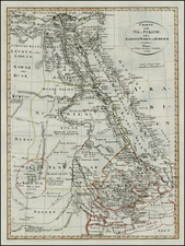
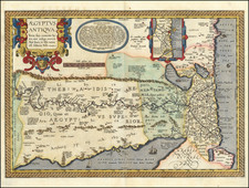
Interesting post-World War II map of Egypt, published by The Egyptian Trade Index in Alexandria and prepared and drawn by Albino Caserta.
The map provides a fine large treatment of Egypt, with a reference key identifying:
- Main Railways
- Medium Railways
- Light Railways
- Roads
- Tracks
- Canals
- Boundaries
Includes two wider regional maps, one of which notes aerodromes and landing grounds in the Egyptian Desert.
Alberto was an Italian mapmaker who lived in Egypt during and after World War II and created several maps
Condition Description
Folding map with original printed covers