|
||

|

|
|

|
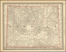
A 19th-century USGS map showing timber in the southwest region of the Black Hills of South Dakota and Wyoming. The map is shaded according to the quality of timber in each area, with darker areas indicating a higher density of harvestable timber.
Complete deforestation never seems to have taken root in this part of the Black Hills, as seen by comparing this map to contemporary satellite photos. However, the Black Hills is one of the National Forest areas which produce the highest amounts of timber in the nation. Much of this is concentrated in the more urbanized northeast part of the Hills. Clearing of the forest in this area is still occurring, and all of the Black Hills are predicted to be completely deforested in as little as 30 years. The area would then lose the meaning behind the name "an island in the plains" that they were given by the first European settlers.
The map is extremely detailed, as with all USGS maps from the modern era. Topography, roads, and creeks are all shown. Names are given to many features and hamlets. In all, this is an interesting map of a very rural part of South Dakota and Wyoming showing the beginnings of an important industry in the area.
![[ Jackson Hole and Environs ] Geological Map of Portions of Wyoming, Idaho and Utah](https://storage.googleapis.com/raremaps/img/small/97191.jpg)
![[ Wyoming Attached To Dakota Territory ] The United States of America](https://storage.googleapis.com/raremaps/img/small/99363.jpg)