|
||

|

|
|

|
Rare plan of Algiers, at the time of the Invasion of 1830.
The map was issued at the time of the 1830 invasion of Algiers, by Vincent Yves Boutin. Boutin was a French colonel of the genie of the Grande Armée during the First Empire . In addition, he led several espionage missions in North Africa, including one at the regency of Algiers in 1808 which helped him plan the conquest of Algeria by France in May 1830.
The map illustrates Algiers at the time of the French Invasion of 1830. The Invasion of Algiers in 1830 was a large-scale military operation by which the Kingdom of France, ruled by Charles X, invaded and conquered the Ottoman Regency of Algiers. Algiers had been a province of the Ottoman Empire since the Capture of Algiers in 1529 by Hayreddin Barbarossa.
A diplomatic incident in 1827, the so-called Fan Affair (Fly Whisk Incident), served as a pretext to initiate a blockade against the port of Algiers. After three years of standstill and a more severe incident in which a French ship carrying an ambassador to the dey with a proposal for negotiations was bombarded, the French determined that more forceful action was required. Charles X was also in need of diverting attention from turbulent French domestic affairs that culminated with his deposition during the later stages of the invasion in the July Revolution.
The invasion of Algiers began on July 5, 1830 with a naval bombardment by a fleet under Admiral Duperré and a landing by troops under Louis Auguste Victor de Ghaisne, comte de Bourmont. The French quickly defeated the troops of Hussein Dey, the Ottoman ruler, but native resistance was widespread. This resulted in a protracted military campaign, lasting more than 45 years, to root out popular opposition to the colonization. The so-called "pacification" was marked by resistance of figures such as Ahmed Bey, Abd El-Kader and Lalla Fatma N'Soumer.
The invasion marked the end of several centuries of Ottoman rule in Algeria and the beginning of French Algeria. In 1848, the territories conquered around Algiers were organized into three departments, defining the territories of modern Algeria.
Rarity
The map is very rare. OCLC locates examples at the Bibliotheque National de France and Harvard.
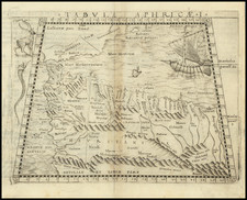
![Tabula Aphricae I [Morocco & Tunisia]](https://storage.googleapis.com/raremaps/img/small/47490.jpg)