|
||

|

|
|

|
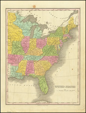
"The Government of the United States is Democratical, under a Congress or Council of Deputies from the different states."
Hand annotated example of Stockdale's map of the Northern and Mid-Atlantic states, annotated by an early owner, with short notes about the United States and Canada, including the quote above.
The map is most notable for the many land grants showing Western Territory, which then included Ohio, Tennessee and the Old Northwest Territory. The grants include Illinois Company, Army Lands, Wagbash Company, New Jersey Company, Ohio Company, and the 7 Ranges, along with the Donation Lands from the Commonwealth of Virginia and General Clark's Grant 1500 acres.
Many settlements are noted in the West, along with early forts (Miami, Pitt, Venango, Chartres) and other interesting features. St. Louis appears on the map, as does Louisville, St. Genevieve, New Madrid, St. Philips, Cahokia, and the Kaskaskai Village.
A nice post-revolutionary war map of the region, with contemporary notes by an early English owner.
![[ New England / Northeast / Canada ] Tierra Nueva](https://storage.googleapis.com/raremaps/img/small/86737.jpg)