This item has been sold, but you can enter your email address to be notified if another example becomes available.


|
||

|

|
|

|
Stock# 58416
Description
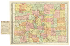
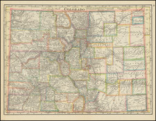
A scarce early Colorado Forestry map, illustrating the forested regions.
The map differentiates between areas which are:
- Not burned or barely burned (green)
- Much burned over by old or recent fires (tan)
- Badly burned (brown)
The map also locates:
- Mining or Prospecting Towns
- Small Camps, Stations or Large Ranches
- Sawmills
- Principal Wagon and Lumber Roads