
This item has been sold, but you can enter your email address to be notified if another example becomes available.


|
||

|

|
|

|
Stock# 3661
Description
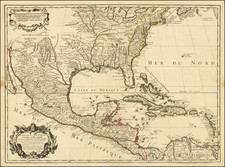
Marvelous regional map, showing the early counties, towns, roads, islands, and other details. Based in part of information derived from Tanner and Brazier, who receive credits in the lower left corner of the map. Information key notes abbreviations for Bridges, Court Houses, Churches, Creeks, Forks, Lakes, Mountains, Post Offices, Points, Springs, Swamps & Villages, Indian Villages, Forts, etc.


![[ Carolinas & Georgia ] Carte De La Caroline Et Georgie . . .](https://storage.googleapis.com/raremaps/img/small/99744.jpg)
![Dominia Anglorum in America Septentrionali Specialibus Mappis Londini primum a Mollio… [4 maps--New England; Chesapeake, Georgia, Carolinas & Florida; and Nova Scotia…]](https://storage.googleapis.com/raremaps/img/small/60331.jpg)
![[French Colonization in Florida and the Southeast] La Floride Francoise Dressee sur La Relation des Voiages que Ribaut, Laudonier, et Gourgues y ont faits in 1562, 1564 et 1567 . . .](https://storage.googleapis.com/raremaps/img/small/91072.jpg)