


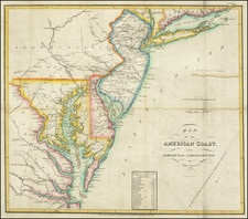
|
||

|

|
|

|
Scarce map of Virginia, prepared by James H. Waddell under the direction of Matthew Fontaine Maury at the Viriginia Military Institute. The map was prepared to accompany the second edition of Maury's Physical Survey of Virginia and replaced the Bucholtz-Ludwig map, which Maury had used in the first edition of his work.
Matthew Fontaine Maury (often called the Pathfinder of the Seas and the Father of Modern Oceanography and Naval Meteorology) was born on January 14, 1806 in Spotsylvania County, Virginia and raised in Franklin, Tennessee. Maury joined the US Navy in 1825, obtaining an appointment through his connection with Senator Sam Houston (later President of the Republic of Texas).
During the years 1834 to 1841, Maury produced published works on sea navigation and detailing sea journeys. He also began writing political essays pushing for navy reform. In 1842, Maury was appointed superintendant of the Depot of Charts and Instruments of the Navy Department in Washington. In this position he began publishing his research on oceanography and meterology, as well as charts and sailing directions. By the fall of 1853 Maury had become internationally recognized for his work. He was sent to an international congress at Brussels as the United States representative. Maury's system of recording the oceanographic data of naval vessels and merchant marine ships was thereafter adopted world-wide. In 1855, he published The Physical Geography of the Sea, which is now credited as "the first textbook of modern oceanography".
Maury had always been very interested in the commercial construction of the South. As tensions increased between the South and the North, his regional interests became solidified. On April 20,1861, three days after Virginia seceeded from the Union, Maury resigned from the United States Navy. Several days later, he accepted the position of commander in the Confederate States Navy. Because of his international fame, he was sent to England as an spokesperson for the Confederate government and the Southern cause. During the Civil War, Maury was successful in acquiring war vessels for the Confederacy and in the progress he made in harbor defense, experimenting with electrical mines.
In 1868 General Francis H. Smith, Superintendent of the Virginia Military Institute, persuaded Maury to return to Virginia to become professor of physics at VMI and to prepare a "physical survey of Virginia." Smith had for some time sought to create a better map of Virginia. Before the Civil War, he he wrote of his plan for "an accurate Geographical map based upon a careful triangulation of the State and such astronomical observations as would fix geographically the principal points in the primary triangulation." After the War, Smith presented in the 1867 report of VMI's Board of Visitors his plan for the school to develop "a complete geographical and geological map" of Virginia as part of a work on "the entire physical geography of the state" and believed that this work would entice Maury to return to Virginia.
In the spring of 1868 Maury wrote Smith that the surveying parties would need instruments and suggested that he, Maury, obtain them while he was still in England. Maury returned from England in the Summer of 1868, which Smith gathered the required cartographic materials for Maury, which included 15 local maps of the Valley of Virginia provided by General Robert E. Lee, drafts of maps by Thomas H. Williamson, professor of engineering and drawing at VMI, and geological information from Col. M. McDonald, head of VMI's department of Minerology and Geology.
Marcus Ammen, who had worked during the war for General Beauregard, J.E.B. Stuart, Fitz Hugh Lee, Rosser, and others and spent eight months making a map of Fairfax Co. VA for Beauregard wrote seeking employment on the project as a "Topographist." Stonewall Jackson's mapmaker, Jedediah Hotchkiss, offered Maury his maps of Augusta and other counties.
While Smith had thought the project feasible, time constraints were such that Smith and Maury decided to use the 1858 Bucholtz map as the base map for the first edition of the Physical Survey of Virginia, with some changes. Bucholtz's engraver, Charles Ludwig, was still in business in Richmond and had access to the 1858 stone or some derivative stone. The first edition (with the Bucholtz map), was sent to the printer in December 1868. Maury suggested paying Ludwig for use of the plate in a second edition, but by that time, the Waddell map had been prepared.
The map and pamphlet have become quite scarce on the market in either of the two editions. We offer the present example of the map with pamphlet.
![[ Middle British Colonies Map ] Pensilvania Maryland and Virginia](https://storage.googleapis.com/raremaps/img/small/98228.jpg)

![[St. Augustine, Florida] Beschreibung des Vorgebürgs Floride/ da die Franzosen anzufahren pflegen/welches von ihnen das Französische Vorgebürg genannt wirdt.](https://storage.googleapis.com/raremaps/img/small/84381.jpg)

