The item illustrated and described below is sold, but we
have another example in stock. To view the example which
is currently being offered for sale, click the
"View Details" button below.
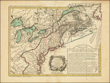
1777 Maurille Antoine Moithey
$ 1,700.00


|
||

|

|
|

|
Stock# 1200p
Description
First edition of this scarce Revolutionary War Map of the British Colonies. The map includes a remarkable amount of historical, topographical and military notes and details concerning the British Colonies and neighboring regions, along with a large inset map of thw Pacific, showing the various French Trading Routes to the new world from Brest, Nantes, Rochefort, Lisbon and Cadiz. One of the earliest general maps of the British Colonies to reflect the commencement of the Revolution. Excellent Indian & Colonial detail, especially in the Ohio Valley and Western Virginia, where a number of early English Forts and Settlements are noted. Sellers and Van Ee 155.
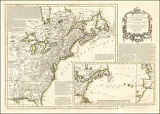
![[Whoever is silent is Complicit -- Anti-Vietnam / Anti-American Poster] Vietnam: Sterminio | chi tace è complice](https://storage.googleapis.com/raremaps/img/small/89365.jpg)
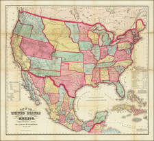
![Vereinigte Staaten Von Nordamerika [United States of America]](https://storage.googleapis.com/raremaps/img/small/79951.jpg)
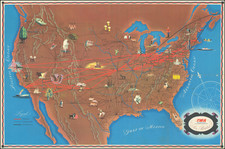
![[Eurpean and American Air Routes] TWA Trans World Airline U.S.A. • Europe • Africa • Asia Air Routes](https://storage.googleapis.com/raremaps/img/small/89027.jpg)