This item has been sold, but you can enter your email address to be notified if another example becomes available.


|
||

|

|
|

|
Stock# 11117
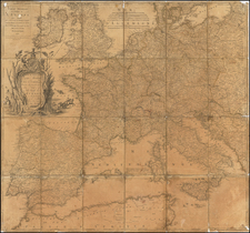
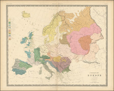
Description
Detailed 19th Century Map of Europe, colored by countries. Shows cities, rivers, mountains, railroads, islands and other features. A good example, in original color, from Black's General Atlas, one of the most popular English language atlases of the second half of the 19th Century.