Search
The work was immensely influential in its time; indeed, after the publication of the first edition in 1745, many copies were destroyed by the French Admiralty, who thought the detailed coverage was too likely to aid enemy ships.
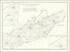
Mannevillette drew on his decades of experience at sea to correct and make improved charts of the waters around the Cape of Good Hope, the Red Sea and Persian Gulf, in the India Ocean and into the South China Sea. The atlas, with 22 charts, was first released in 1745. It improved considerably on the work of John Thornton and the van Keulens, among others.
Mannevillette spent the next thirty years on a second edition of the atlas, often with the help of Britain’s most knowledgeable hydrographer of the East Indies, Alexander Dalrymple. It was finally published in 1775 with 41 additional charts and Mannevillette’s Instructions sur la navigation de France aux Indes. An additional supplement was added in 1781 and again in 1797. The charts were also individually updated, with many having printed paste-overs to correct portions of the charts. While the charts are numbered, customers could also design their own volumes, which is why practically none of the surviving atlases are exactly alike.