
Search
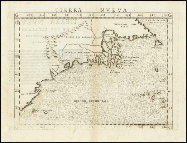
Place/Date:
Venice / 1561
Size:
10 x 7 inches
Condition:
VG
Stock#:
64626
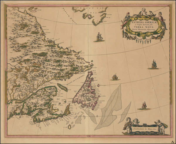
1561 Antique Map of North American Coastline.
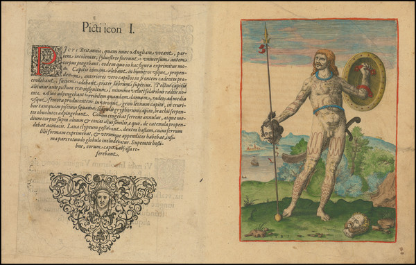
Place/Date:
Frankfurt / 1591
Size:
6.5 x 9 inches Image Only
Condition:
VG
Stock#:
99837
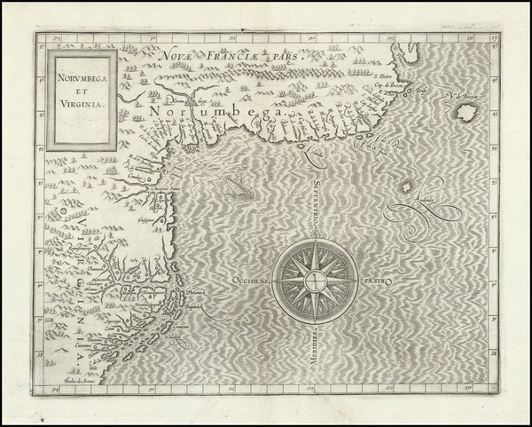
Place/Date:
Louvain / 1597 (1607)
Size:
11.5 x 9 inches
Condition:
VG
Stock#:
98918
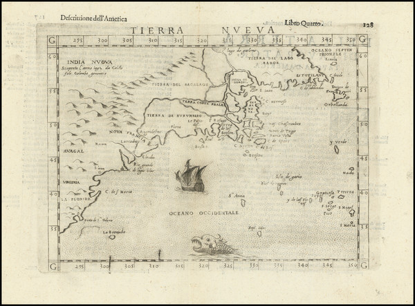
Place/Date:
Venice / 1598
Size:
10 x 7.5 inches
Condition:
VG+
Stock#:
104342

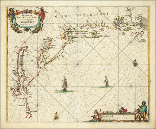
Place/Date:
Venice / 1613 -1583-1606
Size:
9 x 12.5 inches
Condition:
VG
Stock#:
83534
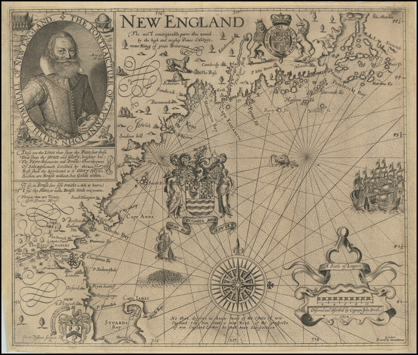
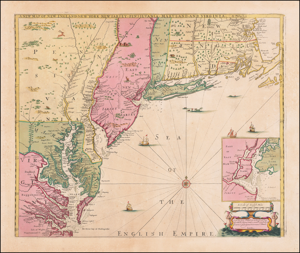
Place/Date:
London / 1616 (1635)
Size:
14 x 12 inches
Condition:
VG
Stock#:
101233
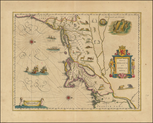
Place/Date:
Antwerp / 1625
Size:
14 x 11 inches
Condition:
VG+
Stock#:
91528
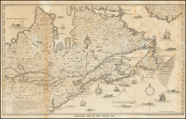
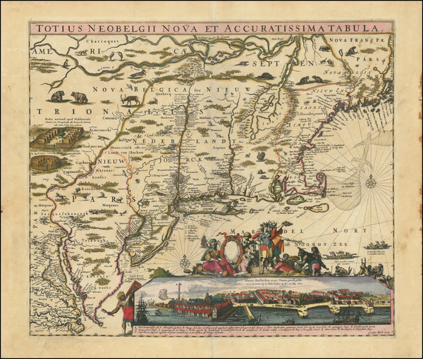
Place/Date:
Albany, NY / 1632 (1850)
Size:
17 x 10.5 inches
Condition:
VG
Stock#:
83894
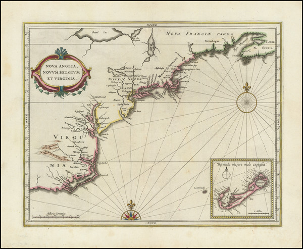
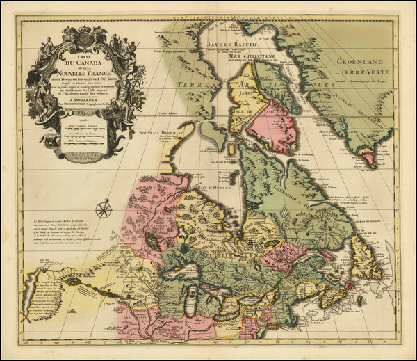
Place/Date:
Amsterdam / 1637
Size:
20 x 15.5 inches
Condition:
VG
Stock#:
91920
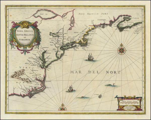
Place/Date:
Amsterdam / 1640 circa
Size:
20 x 15.5 inches
Condition:
VG+
Stock#:
91974
Place/Date:
Amsterdam / 1651 (1660 ca)
Size:
20.5 x 17.5 inches
Condition:
VG
Stock#:
99319
Place/Date:
Amsterdam / 1659
Size:
21.5 x 17 inches
Condition:
VG
Stock#:
82505
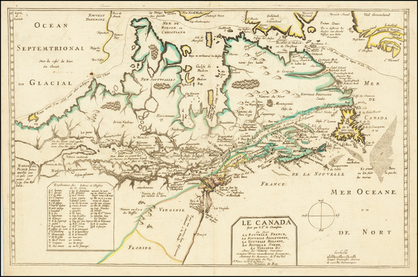
Place/Date:
Paris / 1661
Size:
19 x 15.75 inches
Condition:
VG
Stock#:
104884
Place/Date:
Amsterdam / 1666
Size:
21 x 17 inches
Condition:
VG
Stock#:
66883op
Place/Date:
Paris / 1670 circa
Size:
21.5 x 14 inches
Condition:
VG+
Stock#:
67805
155
Place/Date:
London / 1674 circa
Size:
21.5 x 16.5 inches
Condition:
VG+
Stock#:
69704mb
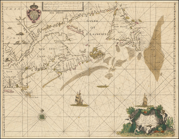
Place/Date:
London / 1674
Size:
21 x 17 inches
Condition:
VG
Stock#:
80520
Place/Date:
n.p. (Salem, Massachusetts?) / 1674 [but written ca. 1830]
Size:
8 x 12 inches
Condition:
Good
Stock#:
93113
Place/Date:
Amsterdam / 1675 (1680)
Size:
20 x 16.5 inches
Condition:
VG
Stock#:
67241
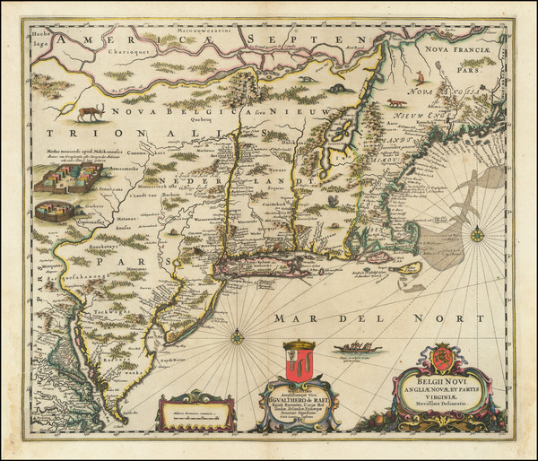
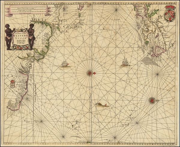
Place/Date:
Amsterdam / 1675
Size:
22.5 x 19 inches
Condition:
VG+
Stock#:
73515
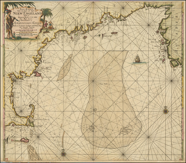
De Wit's 1675 rare map showing New England.
Place/Date:
Frankfurt / 1679
Size:
12 x 8.25 inches
Condition:
VG
Stock#:
97902
Place/Date:
Amsterdam / 1680
Size:
23.5 x 20 inches
Condition:
VG
Stock#:
79385
Place/Date:
Amsterdam / 1680 circa
Size:
21 x 18.25 inches
Condition:
VG
Stock#:
91239
Place/Date:
Amsterdam / 1680
Size:
23.5 x 20 inches
Condition:
Fair
Stock#:
94147
Place/Date:
Paris / 1683
Size:
4.5 x 6 inches
Condition:
VG+
Stock#:
97657
Mallet's 1683 antique map showing New England.

Place/Date:
Paris / 1683
Size:
4.5 x 6 inches
Condition:
VG
Stock#:
103167
Original map showing New England by Mallet, 1683.

Place/Date:
Amsterdam / 1684 circa
Size:
21.5 x 18.5 inches
Condition:
VG
Stock#:
93874
Place/Date:
London / 1685 (1715 ca)
Size:
21.5 x 18 inches
Condition:
VG+
Stock#:
60306op
Original map showing New England by Morden / Lea / Willdey / Thornton made in 1685.
Place/Date:
Amsterdam / 1690 circa
Size:
22 x 17.5 inches
Condition:
VG
Stock#:
91579
Rare map showing New England by Covens & Mortier made in 1690.

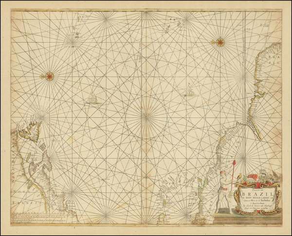
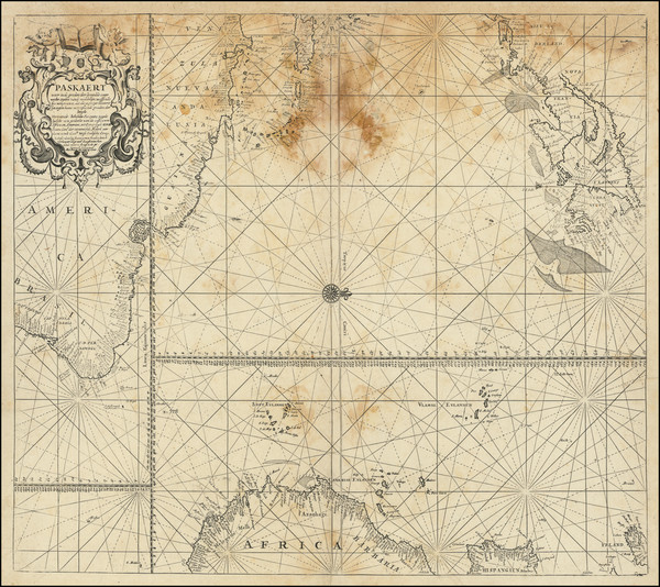
Place/Date:
Amsterdam / 1695 circa
Size:
39 x 32 inches
Condition:
VG
Stock#:
46848
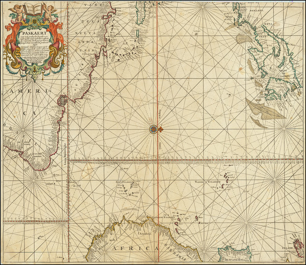
17th Century Dutch Sea Chart on Vellum
Place/Date:
Amsterdam / 1695 circa
Size:
23 x 20 inches
Condition:
VG+
Stock#:
94453
Van Keulen's 1695 antique map showing New England.
Place/Date:
Amsterdam / 1696
Size:
23 x 18.5 inches
Condition:
Good
Stock#:
75875
Place/Date:
Amsterdam / 1696
Size:
22.5 x 34.5 inches
Condition:
VG
Stock#:
99328
Place/Date:
Munich / 1700
Size:
13.75 x 9 inches
Condition:
VG
Stock#:
95667
Place/Date:
Oxford / 1700
Size:
19 x 14 inches
Condition:
VG
Stock#:
98233

Place/Date:
Amsterdam / 1702
Size:
23 x 20.5 inches
Condition:
VG
Stock#:
33948mb
Early Sea Chart of Manhattan, Long Island, Nantucket, Martha's Vineyard, Block Island, Hudson River, New England
Place/Date:
Nuremberg / 1703
Size:
22 x 19 inches
Condition:
VG
Stock#:
78398
Place/Date:
Leiden / 1714
Size:
12 x 9 inches
Condition:
VG+
Stock#:
84832
Place/Date:
Leiden / 1715
Size:
9 x 6 inches
Condition:
VG+
Stock#:
92418
Place/Date:
Nurmberg / 1716
Size:
22.5 x 19 inches
Condition:
VG
Stock#:
100105
Place/Date:
Amsterdam / 1719
Size:
22 x 18 inches
Condition:
VG
Stock#:
61480
Place/Date:
London / 1719
Size:
23.5 x 20 inches
Condition:
VG
Stock#:
74465
Rare map showing New England by Senex made in 1719.
Place/Date:
Amsterdam / 1719
Size:
17 x 14.5 inches
Condition:
VG+
Stock#:
93146
Place/Date:
Amsterdam / 1730 circa
Size:
22 x 19 inches
Condition:
VG+
Stock#:
94450
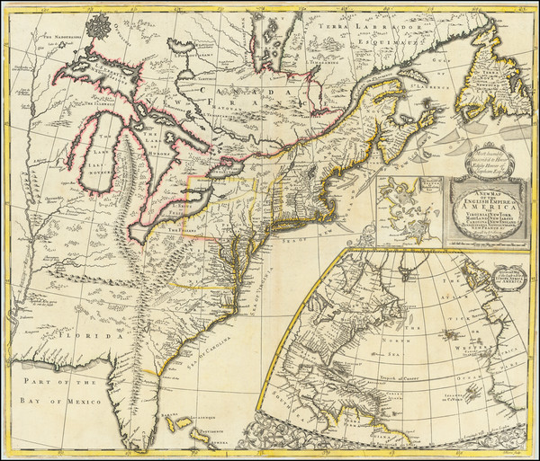
Place/Date:
London / 1733
Size:
24.5 x 40.5 inches
Condition:
VG+
Stock#:
101277
Place/Date:
Amsterdam / 1737
Size:
20.5 x 22 inches
Condition:
Good
Stock#:
64717
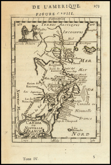
Place/Date:
Paris / 1738
Size:
9 x 6 inches
Condition:
VG+
Stock#:
91075
Place/Date:
Nuremberg / 1745
Size:
22 x 19 inches
Condition:
VG
Stock#:
99315
Place/Date:
London / 1746
Size:
18.5 x 13.5 inches
Condition:
VG
Stock#:
55886
Antique map showing New England by Gentleman's Magazine, 1746.
Place/Date:
London / 1747
Size:
17 x 14 inches
Condition:
VG+
Stock#:
103556