|
||

|

|
|

|
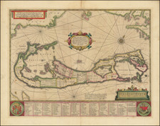
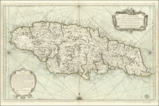
This pair of maps on one sheet, produced in 1746 by the Parisian mapmaker Georges Louis Le Rouge, is notable for depicting English-held territories in the Caribbean and Atlantic. The map, part of Le Rouge's Atlas Nouveau Portatif, offers a unique historical perspective on colonial holdings and maritime navigation of the mid-18th century.
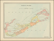
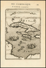
The period of the 1740s was marked by intense European colonial competition, particularly in the Caribbean and North American regions. The British Empire, amidst its vast expansion, was heavily involved in the sugar and slave trades, with Jamaica serving as a critical colony. The map captures this era's geopolitical dynamics, presenting Jamaica and Bermuda as critical nodes in British maritime and colonial activities. Bermuda's portrayal, in particular, highlights the significance of these islands in transatlantic navigation and as strategic military outposts.
The map of Jamaica marks cities ('Villes'), parishes ('Paroisses'), and key commodities such as sugar ('Sucrerie'), cotton ('Coton'), indigo, and cocoa ('Cacao').
The map of Bermuda includes a notable cartographic error, a lingering ghost of Bermuda (named 'Bermudos') from John Speed's 1627 map. In Speed's map, Bermudos was shown in smaller form as part of contextualizing the island with in the broader context of the North American coast. Over time that purpose was lost and a phantom island appeared on other mapmaker's maps.
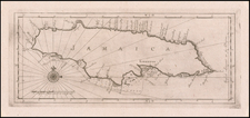
![[Jamaica] L'Isle de la Jamaique. par M. T. J. Ingenieur Anglois a Paris, 1779](https://storage.googleapis.com/raremaps/img/small/91165.jpg)