|
||

|

|
|

|
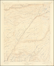
A Proposed Military Boundary Between Mexico and the United States in January 1848
Fascinating manuscript map of the Southwest and Mexico, drawn to illustrate a prospective military border between Mexico and the United States toward the end of the Mexican War (1846-1848).
Dated January 28, 1848, the map was drawn several weeks after the final battles of the war and just days before the signing of the Treaty of Guadalupe Hidalgo, on February 2, 1848. Captain J. William Cole (likely John William Cole), refers to himself as part of the Louisiana Regiment, almost certainly the Regiment of Louisiana Volunteers, who served from December 1846 to July 1848, under the command of Colonel Louis G. De Russy (formerly Capt. U.S. Artillery and Paymaster). Cole would go on to form and lead the 21st Regiment Louisiana Militia in 1849 and later Cole's Louisiana Mounted Rangers at the beginning of the American Civil War.
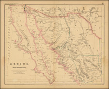
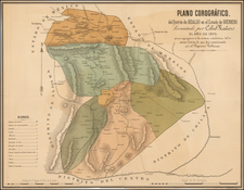
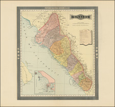
The main map extends from Texas and the southernmost parts of today's New Mexico, Arizona and California, to the Mexican States of Vera Cruz, Queretaro and Guadalajara, outlining the major geographical features (mountains, rivers, lakes, major cities and boundaries between Mexican States). The two smaller inset maps illustrate the areas around Tampico and the lower part of the Tamasi River, with annotations discussing the prospective navigability of the River. Cole was apparently at a place called Tancasnique, "being situated on the northside of the Tamasi river - distance 140 miles from Tampico."
The purpose of the map seems to be laid out in the text at the upper left:
Suggested and arranged by Captain J. Warren Cole, La. Reg[iment], Tancasnique, Jan. 26th 1848 the Seramadra [Sierra Madre] Mountains to be the line of defences between the central government of Mexico and the states north of the Seramadra Mountains: those states to be occupied by the American army, until a judicious and permanent peace shall be brought about between the government of the United States of America and the goverrnment of the Republic of Mexico.
According to historian Peter Guardino, a guerrilla war continued to rage for several months after General Scott's entry and taking of Mexico City, and nearly up to the signing of the Treaty of Guadalupe Hidalgo. Volunteer regiments, as opposed to regular U.S. Army units, were often assigned counterinsurgency duties. Captain J. William Cole, being with the Louisiana volunteers, may have been part of the garrison at Tampico and thus strategically placed to consolidate efforts against guerrilla fighters. But as Guardino states: "...the Mexican government lacked the financial resources needed to field new conventional armies, and the military consensus was that guerrilla resistance alone was not enough to defeat an invading conventional army" - The Death March: a History of the Mexican-American War, page 305.
Rarity
Such finely finished maps made during the Mexican War and relating to the ongoing conflict are rare in the market.