|
||

|

|
|

|
Spanish Cartographers Attempt to Make Sense of Cook's Third Voyage Information.
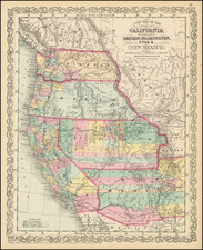
This unique Spanish manuscript map delineates the North Pacific down to Hawaii, the majority of North America (with a particular focus on the interior West), and the Pacific coast of Russia, converging the discoveries of Juan Francisco de Bodega y Quadra (1775-1779), Cook (1776-1780), and Russian expeditions. This map, likely conceived around 1781, captures a nascent phase of Spanish knowledge assimilation regarding these regions, characterized by emerging understanding, but also transcription errors and remnants of past mistaken beliefs. The map probably reflects the early dissemination of information from Cook's Third Voyage, before the widespread availability of accurate data when the official account was published in 1784. The map can be seen as an attempt by the Spanish to update Buache and Delisle's foundational 1752 map of the North Pacific, the Carte Des Nouvelles Decouvertes Au Nord de la Mer de Sud.
Historical Context: Emerging Spanish Awareness of the British Threat to Their Pacific Hegemony
Before the 1780s, Spanish concerns in the North Pacific focused on Russian advancements in the far northwest. Since Balboa's sighting of the Pacific Ocean in 1513, Spain had largely regarded this vast expanse as its exclusive domain, with only intermittent challenges from other European powers. However, in the 18th century, Russia's burgeoning interest in the North Pacific began to manifest more assertively, signaling a shift in the geopolitical landscape. This period saw a crescendo of Russian exploration and fur trade activities, particularly in areas now part of Alaska. The late 1770s and early 1780s, however, marked a pivotal turn in Spanish foreign policy attention, increasingly directed towards British movements. This shift was catalyzed by events such as Captain James Cook's voyages, which not only highlighted the strategic and economic potential of the Pacific Northwest but also underscored the burgeoning British naval and exploration prowess. Cook's expeditions, notably his third voyage (1776-1780), during which he charted parts of the North American west coast and the Hawaiian Islands, significantly heightened Spanish apprehensions about British intentions in regions Spain had long considered under its influence.
This growing concern was further exacerbated by the establishment of a substantial British base in Australia in 1788. This strategic move by Britain, expanding its maritime and colonial influence into the Pacific, signaled a major shift in the global balance of power. The creation of the colony at Sydney Cove represented a new phase in British expansionism and underscored the increasingly multipolar nature of exploration and territorial claims in the Pacific. For Spain, which had for centuries considered the Pacific Ocean as its sphere of influence, the British establishment in Australia was a stark realization of the emerging British challenge to its Pacific hegemony. Consequently, Spain was compelled to reassess its maritime strategy and colonial policies, recognizing the growing presence of other European powers, particularly Britain, in territories Spain had once claimed exclusively. In short order, this would lead to the Nootka Controversy and the subsequent cession of Spanish claims to the Northwest.
This map is a snapshot from the beginning of that transition, before these geopolitical shifts were fully realized, capturing a moment when the Pacific remained a contested space of overlapping interests and claims. It reflects the complexity of this historical juncture, where traditional notions of territorial rights were beginning to unravel under the pressure of new imperial ambitions.
The Interior West
This map provides a comprehensive view of the Western interior of North America in the late 18th century, blending geographical discoveries with mythological and speculative elements. It marks unique Spanish attempt to chart and understand this vast and largely unexplored territory.
Key features include "Tierra pantanosa de Tuyares," an early reference to Lake Tulare, and "Aqui ponian antiguamente la Quivira," indicating the mythical city of Quivira. The map also delineates various water bodies such as Lago de Timpangos and Lago de Teguayo, alongside "Rio de Totlas, o de los Reyes", reflecting the blend of accurate and conjectural geography of the time.
Indigenous settlements and territories, such as Los Cobagis, Los Nochis, Cocomariopas, Los Yumas, and Los Apaches Yamparicas, are documented, providing insights into the region's demographic and cultural landscape from a Spanish perspective.
Provenance
- Sotheby Atlases, Maps and Printed Books, 21 May 1984, lot 350, £3,960;
- Robinson
- W. Graham Arader III, Catalog 49, Summer 1984, Item 7 ("An excellent compilation of knowledge about the Pacific Northwest as of about 1780."), $25,000;
- Private American collection
![Pascaart vertoonende de zeecusten van Chili, Peru, Hispania Nova, Nova Granada, en California…. [Early New Zealand Inset]](https://storage.googleapis.com/raremaps/img/small/65168.jpg)
![Oahu [Hawaiian Islands 1:25,000]](https://storage.googleapis.com/raremaps/img/small/96167.jpg)