|
||

|

|
|

|
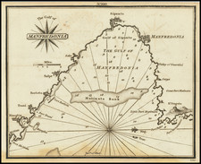
Amalfi Coast to Gulf of Policastro
Fascinating mid 17th Century map of Principato Citra olim Picentia, covering today's Province of Salerno, specifically the area once known as Picentia in the Campania region of Italy.
The map encompasses the territory approximately aligning with today's Province of Salerno, including the idyllic towns of the Amalfi Coast.
During the first half of the 17th century, this region was under Spanish rule. The map meticulously marks significant towns such as Naples, Salerno, Torre, and Policastro Bussentino, along with Marsico Nuovo, Campagna, and Muro Lucano, reflecting the dense habitation and strategic importance of the region. The Amalfi Coast, known for its extraordinary beauty and maritime prowess, is represented by towns that have been pivotal in the area's economic and cultural history.
The map's historical significance is underscored by the geopolitical context of the area it represents. Naples, originally a Greek settlement named Neapolis, had by then experienced Roman rule and witnessed the rise and fall of numerous empires. By the 17th century, Naples was one of Europe's largest cities, its political narrative characterized by a series of foreign dominations. The region's earlier history, marked by Roman expansion, is still traceable through archaeological remains.
By the period the map portrays, the Lombard invasion of 568 had significantly altered Italy's landscape, and the ducats under the Exarchate of Ravenna, including Naples, had established the region's Byzantine connections. The Normans had also left their mark, establishing their first territory in Southern Italy with the county of Aversa north of Naples. The 1442 Aragonese conquest of Naples from the French Angevins brought about both destruction and a renewed economic vigor, tying Naples closer to the Iberian Peninsula and ushering in an era of Renaissance and humanism. However, the Habsburgs' Spanish rule was punctuated by revolts and the brief establishment of the Neapolitan Republic during the Crisis of the 17th Century.
The geopolitical landscape during the first half of the 17th Century in the region depicted was one of turbulence and transition, which would eventually lead to a marked improvement when the Bourbons claimed Naples in the War of the Polish Succession, freeing it from Austrian control and catalyzing a period of prosperity and cultural florescence.
The cartouches, compass rose, and sailing ships embellishing the map are not merely decorative but are emblematic of the era's artistic sensibilities and the region's maritime heritage.
Joan, or Johannes, Blaeu (1596-1673) was the son of Willem Janszoon Blaeu. He inherited his father’s meticulous and striking mapmaking style and continued the Blaeu workshop until it burned in 1672. Initially, Joan trained as a lawyer, but he decided to join his father’s business rather than practice.
After his father’s death in 1638, Joan and his brother, Cornelis, took over their father’s shop and Joan took on his work as hydrographer to the Dutch East India Company. Joan brought out many important works, including Nova et Accuratissima Terrarum Orbis Tabula, a world map to commemorate the Peace of Westphalia which brought news of Abel Tasman’s voyages in the Pacific to the attention of Europe. This map was used as a template for the world map set in the floor of the Amsterdam Town Hall, the Groote Burger-Zaal, in 1655.
Joan also modified and greatly expanded his father’s Atlas novus, first published in 1635. All the while, Joan was honing his own atlas. He published the Atlas maior between 1662 and 1672. It is one of the most sought-after atlases by collectors and institutions today due to the attention to the detail, quality, and beauty of the maps. He is also known for his town plans and wall maps of the continents. Joan’s productivity slammed to a halt in 1672, when a fire completely destroyed his workshop and stock. Joan died a year later and is buried in the Westerkerk in Amsterdam.
![[Spanish Siege of Ostia] Il Vero Disegno Del Sito Di Hostia e Di Porto Con Li Forti Fatti Dal Campo Di Sua Santita et Delli Imperiali Qualisi Resero Adi XXIIII Genaro M. D. L V II . . . .](https://storage.googleapis.com/raremaps/img/small/75401.jpg)
![Southern Italy [Sicily, Sardinia, Corsica]](https://storage.googleapis.com/raremaps/img/small/91814.jpg)
![[Pozzuoli / Napoli] Explicatio aliquot locorum quae Puteolis spectantur](https://storage.googleapis.com/raremaps/img/small/58733.jpg)
![[ Amalfi Coast / Salerno ] Principato Citra olim Picentia](https://storage.googleapis.com/raremaps/img/small/98621.jpg)
![[ Lazio ] Campagna di Roma, olim Latium: Patrimonio Di S. Pietro; et Sabina](https://storage.googleapis.com/raremaps/img/small/98622.jpg)