|
||

|

|
|

|
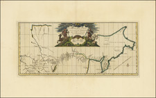
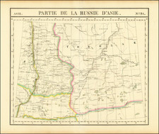
Detailed map of the Wrangel Island (also known as Wrangel Land) and the surrounding maritime regions, including parts of Alaska. These maps specifically outline the routes taken by American steamers during exploratory expeditions in the years 1880 and 1881.
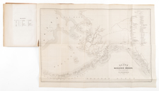
The first image is an inset from the larger map and focuses on Wrangel Island itself, labeled as "NEW COLUMBIA" or "NEU COLUMBIA" in the German text. It provides a closer look at the topography and coastal features of the island. The key below the inset map indicates various paths and explorations with corresponding leaders and dates:
- The paths of the U.S. Revenue Steamer "Corwin" under Captain C. L. Hooper from June to September 1880.
- The tracks of the U.S. Steamer "Rodgers" under Captain R. M. Berry in July to September 1881.
- The excursions of officers Washing & Hunt in September 1881.
The second image shows the full map, which includes a larger area of the Arctic Ocean, the Bering Sea, and parts of northeastern Siberia and Alaska. This map details the navigational paths of the vessels "Corwin" and "Rodgers" during their respective voyages. The solid and dashed lines represent different routes and years of the expeditions:
- The solid red line denotes the course of the "Corwin" under Captain Hooper in 1880.
- The dashed red line illustrates the route of the "Rodgers" under Captain Berry in 1881.
These expeditions were part of a series of voyages conducted during that period, aimed at exploring the Arctic regions, conducting scientific research, and in some cases, searching for missing expeditions from previous years. Wrangel Island was of particular interest during this era of exploration due to its strategic location in the Arctic and the potential for new discoveries in geography, natural resources, and sea routes.
August Heinrich Petermann (1822-1878) is a renowned German cartographer of the nineteenth century. Petermann studied cartography at the Geographical Art-School in Potsdam before traveling to Edinburgh to work with Dr. A. Keith Johnston on an English edition of Berghaus’ Physical Atlas. Two years later he moved to London, where he made maps and advised exploratory expeditions as they set off to explore the interior of Africa and the Arctic.
In 1854, Petermann returned to Germany to be Director of the Geographical Institute of Justus Perthes in Gotha. There, he was the editor of the Geographische Mittheilungen and Stieler’s Handatlas. The Royal Geographical Society of London awarded him their Gold Medal in 1860. He continued his interest in exploration in Germany, fundraising for the German Exploring Expeditions of 1868 and 1869-70, which sought an open Arctic sea. Tragically, he committed suicide in 1878.
![(Mount St. Elias and Mt Fairweather to Cape Decision, Stika, Juneau and Prince Frederick Sound) Cote Nord-Ouest De L'Amerique Reconnue Par Cape. Vancouver Ve. Partie [Northwest Coast of America as recognized by Captain Vancouver, 5th Part]](https://storage.googleapis.com/raremaps/img/small/88128.jpg)