|
||

|

|
|

|
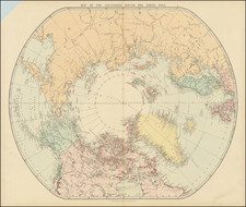
Polaris Expedition -- An Early Attempt To Reach The North Pole
Detailed map showing the route of an Arctic expedition undertaken by the American explorer Charles Francis Hall.
This map represents the route and observations made during the Polaris expedition, one of the first attempts to reach the North Pole in 1871-1873. Hall's journey was significant for its contributions to polar exploration and for the tragic events that ultimately led to Hall's death and the stranding of his crew.
The map covers the journel from the Atlantic Ocean to Grinnells Land, highlighting the Arctic regions explored during the expedition. It is meticulous in its detail, showing various routes taken by the expedition, marked with dates and navigational observations. This detailed cartography serves as a historical record of the expedition's path, including the course of the expedition's ship, the Polaris, and the movement of ice floes that played a critical role in the expedition's fate.
Details shown on the map include the course of the expedition's ship from August 1871 to October 1872, the course of a smaller party 19 people from the expedition from October 1872 to April 1873, and other scientific observations such as air temperature and wind direction.
Charles Francis Hall was an explorer who aimed to reach the North Pole and made several voyages to the Arctic. The expedition marked on this map was his final and most ambitious one. Hall was not a formally trained scientist, but he gathered a significant amount of geographical and meteorological data that contributed to the understanding of the Arctic region. Tragically, Hall died under mysterious circumstances during the expedition, and the crew members faced a harrowing survival situation after the ship was caught in the ice.
Historically, the expedition is significant as it marked a period of intense interest in Arctic exploration, driven by the desire to discover new trade routes, national prestige, and scientific curiosity. Although the Polaris expedition did not achieve its goal of reaching the North Pole, it added to the collective knowledge of Arctic conditions and paved the way for future explorers. The places reached and the data collected offered insights into the geographical and environmental conditions of the far north, which were largely unknown at the time.
August Heinrich Petermann (1822-1878) is a renowned German cartographer of the nineteenth century. Petermann studied cartography at the Geographical Art-School in Potsdam before traveling to Edinburgh to work with Dr. A. Keith Johnston on an English edition of Berghaus’ Physical Atlas. Two years later he moved to London, where he made maps and advised exploratory expeditions as they set off to explore the interior of Africa and the Arctic.
In 1854, Petermann returned to Germany to be Director of the Geographical Institute of Justus Perthes in Gotha. There, he was the editor of the Geographische Mittheilungen and Stieler’s Handatlas. The Royal Geographical Society of London awarded him their Gold Medal in 1860. He continued his interest in exploration in Germany, fundraising for the German Exploring Expeditions of 1868 and 1869-70, which sought an open Arctic sea. Tragically, he committed suicide in 1878.
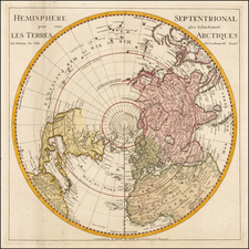
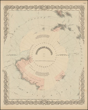
![Tabula Geographica Hemisphaerii Borealis ad emenatiora quae adhuc prodieruntexampla jusqu Acad. Reg. Scient. et Eleg. Litt. Boruss. descripta [with:] Tabula Geographica Hemisphaerii Australis...](https://storage.googleapis.com/raremaps/img/small/81806.jpg)