


|
||

|

|
|

|
Detailed map of the northern region of Bryce Canyon National Park in Utah, reflecting the surveying work undertaken in 1931-1932 and reprinted in 1947.
The map offers a topographical perspective of the area, capturing the region's geological formations and the existing roads and trails.
The red lines note the paved and unpaved routes, dirt roads, seasonal roads, etc., through the region, as of 1946. The map shows public and private roads, buildings, trails, Triangulation points, elevations, streams, seasonal streams, irrigation ditches, lakes, seasonal lakes, springs and marshes.
The 1930s were a significant time for the American National Park Service. With the introduction of New Deal programs, there was an increased focus on conservation efforts. Bryce, known for its distinct landscape of cliffs, canyons, and diverse ecology, was an integral part of this conservation initiative. By the time this map was created in 1938,
The map's design is thorough, with contour lines marking elevation changes and boundaries clearly outlined. The included legend clarifies the symbols representing various geographical features, such as trails, roads, springs, and streams.
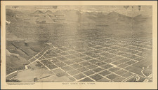
![(Salt Lake City) A Reflex of Salt Lake City and Vicinity [including:] Birds-Eye View of Salt Lake City from the S. E.](https://storage.googleapis.com/raremaps/img/small/93790.jpg)
![[Roosevelt, Utah]](https://storage.googleapis.com/raremaps/img/small/71605.jpg)