|
||

|

|
|

|
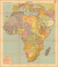
This propagandistic postcard map, produced by the Deutscher Lichtbilddienst in Berlin during the 1930s, captures the escalating atmosphere of militarization in Germany, portraying the nation within the crosshairs of its neighbors' aerial capabilities. Through the map's foreboding design and symbolism, it communicates the perceived threats faced by Germany amid the geopolitical frictions of pre-World War II Europe.
The map's ominous visual elements, designed to evoke a sense of urgency and danger, illustrate the potential radius of foreign bombers over German territory. The vibrant red and green colors demarcate boundaries and spheres of threat with stark clarity, while the marked cities and industrial regions underscore the perceived vulnerabilities to the German populace.
Within the broader historical narrative, this map indicates Germany's intention to rally national sentiment by amplifying the specter of encirclement and potential invasion. This map, thus, becomes a poignant visual aid that elucidates the particular brand of cartographic manipulation used during this era of tension and uncertainty.