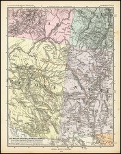
|
||

|

|
|

|
Jerome, Arizona in 1927: A Company Town
A fire insurance atlas of Jerome, Arizona, in the Black Hills of Yavapai County, produced by the Sanborn Map Company in July 1924 and updated in October 1927. This atlas offers a detailed record of the built environment of this copper mining town, dominated by the United Verde Copper Company. Comprising 3 unbound sheets with 5 hand-colored maps, the atlas was originally made as a specialized tool for insurance company underwriters in determining the degree of fire risk associated with any property shown therein. Today it is an unrivaled visual record of Jerome's urban landscape at that time.
Executed with a scale 50 feet to an inch, the atlas shows every building in Jerome with block-by-block, street-by-street, structure-by-structure, color-coded representations. Use of each structure is given: dwelling, grocery, storage, pool hall, lumber yard, movie theater, church, hardware, water tower, etc., often recording the name of the individual business owner. Color coding denotes building material.
In the 1920s, Jerome, Arizona, was a booming mining town situated in Yavapai County. Perched on the slopes of Cleopatra Hill, it was once known as the "Wickedest Town in the West" due to its raucous atmosphere filled with saloons, gambling halls, and a transient population. The town thrived primarily on copper mining, led by the United Verde Copper Company. The mine was among the most productive in the world at the time, supplying vast amounts of copper especially during World War I. In 1917 Jerome made headlines with labor unrest when Wobblies (members of the Industrial Workers of the World) were removed at gunpoint, loaded into a cattle car and shipped west. However, by the end of the 1920s, the once abundant ore began to deplete, signaling the beginning of Jerome's economic decline. Despite its challenges, the town was home to a diverse population, including a number of immigrants who came in search of employment opportunities in the mines. Today the town survives mainly due to tourism.
Here follows a selection of the structures and sites shown in the atlas:
- Bartlett Hotel Dwellings
- Grand Central Hotel
- Hotel Connor
- Hotel Jerome
- Jerome High School
- Little Daisy Hotel
- Sullivan Hotel
- United Verde Co. Hospital (both the older vacant structure and a current facility)
- United Verde Copper Co. mining operations (two full sheets)
- United Verde Copper Co. Dwellings
Rarity
The Jerome, Arizona Sanborn atlas is very rare in the market. Our edition, updated to 1927, may be a unique surviving exemplar of the 1924 iteration with such updates. OCLC locates a 1910 edition held by the University of Arizona. The Library of Congress has digitized editions of 1898, 1901, 1910, and 1917. As of this writing LC has not made their two editions of the 1924 atlas available online.
The Sanborn Map Company, founded in the 1860s by Daniel Alfred Sanborn, is a renowned cartographic institution primarily recognized for its unparalleled fire insurance atlases. These atlases emerged as indispensable tools during the late 19th and early 20th centuries, portraying the evolution of urban America with unprecedented detail and precision. Charting both burgeoning metropolises and smaller municipalities, Sanborn's fire insurance maps provide a unique and illuminating perspective on the physical, economic, and social transformation of the nation during a period of intense urbanization and industrialization.
During the latter half of the 19th century, the United States witnessed an acceleration in urban growth. This shift from rural to urban living, bolstered by the advent of the Industrial Revolution, generated densely populated areas with a diverse array of architectural styles, materials, and infrastructure. In this context, the need for comprehensive maps that could illustrate the specifics of the built urban fabric became paramount, especially for insurance companies seeking to assess the risks associated with insuring individual properties. The Sanborn Map Company responded to this demand, creating elaborate maps that identified building materials, the purpose of structures, and even features like fire walls and sprinkler systems.
A standout feature of Sanborn's maps was their color-coding system, which allowed for a swift and clear differentiation between building materials—whether wood, brick, iron, or otherwise. This system, paired with the company's legends -- detailing everything from the width of streets to the locations of hydrants -- made these atlases an invaluable resource for insurance underwriters. By the turn of the 20th century, Sanborn maps covered thousands of cities and towns across the United States.
Beyond their utility to the insurance industry, the atlases produced by the Sanborn Map Company have, over time, become a treasured resource for historians, urban planners, preservationists, and environmental researchers. These maps have also been pivotal in brownfield research, shedding light on past industrial activities and potential contamination sites. They offer a window into the past, capturing the architectural, infrastructural, and environmental trends of various eras, and revealing the intricacies of a city's development. The very design of streets, the evolution of residential and commercial areas, and the rise and decline of certain industries can be traced through these maps.
Around 1960, Warren Buffett, then a burgeoning value investor, took a significant position in Sanborn Map Co., sinking 35% of his partnership's money into the company. Buffett was drawn to Sanborn's extensive map business, which he described as a virtual monopoly, as well as the company's valuable investment portfolio. While the cartographic aspect of Sanborn's business was diminishing in profitability due to technological advances introduced by competitors, Buffett recognized that the informational content of the maps had not been updated to electronic access, and was thus an undervalued asset for the company. His investment in Sanborn Map Co. is often presented as Case Study No. 1 in overviews of his value-oriented investment philosophy, which emphasized undervalued assets.
In sum, the Sanborn Map Company's fire insurance atlases are not merely maps; they are intricate tapestries of American urban history, detailing the nation's progression from the late 19th to the 20th century. Through their detailed renderings, these maps continue to serve as invaluable chronicles of the United States' urban transformation during a pivotal era.
![[ Southwest & Texas ] Le Nouveau Mexique, Avec La Partie Septentrionale De L'Ancien, ou De La Nouvelle Espagne](https://storage.googleapis.com/raremaps/img/small/99395.jpg)
![[Composite Atlas of the World]](https://storage.googleapis.com/raremaps/img/small/99938.jpg)
![[Austins Colony] Mexico & Guatemala](https://storage.googleapis.com/raremaps/img/small/94054.jpg)
![(Cassini Moon Map) Atlas Céleste de Flamstéed, approuve par l'Académie Royale des Sciences, et publié sous le privilege de cette compagnie [with:] Reduction de la Grande Carte de la Lune de J. Dom. Cassini](https://storage.googleapis.com/raremaps/img/small/79182.jpg)