|
||

|

|
|

|
Early Two-Part Map of North Africa
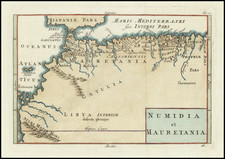
A wonderful set of two maps on one sheet covering the coast of North Africa, known as Barbary (Latinized as Barbaria). The two maps read "Barbaria versus Occidentem" and "Barbaria versus Orientem," which translates to Barbary from the East/West.Key locations are depicted on the map. The most notable inclusions are those cities of Classical significance (like Alexandria or Roxa) or trade importance (such as Cario and the area between the Strait of Gibraltar).
The map mainly focuses on the coast of North Africa, likely due to the active trade economy of the region. Many of the cities shown are ports or very close to the coast. There are some curious city depictions shown, notably that two cities of Tripoli are shown side by side.
This map is from the German Du Val edition printed in 1681 by Hoffmann. It was adapted from earlier work done by Pierre Du Val.
Here is an example of the second state, with a revised page number.
Coat of Arms
The secondary sheet that is featured with this map is the coat of arms of the three notable polities in the region: Barbary, the Kingdom of Morocco, and the Kingdom of Egypt. Accompanying this engraving is a description of the three heraldic symbols which help explain the illustration more.
The first coat of arms represents Barbary, featuring an inverted silver crescent moon on a light red shield, symbolizing distinctive regional attributes. The Kingdom of Morocco's coat of arms follows, depicted as three silver wheels on a gold background, reflecting its historical role as a trade and travel hub. Lastly, the Kingdom of Egypt's coat of arms is displayed, showing three black snakes on a gold field, a design embodying Egypt's symbolic association with snakes in themes of knowledge, life, or creation.
Pierre Duval (1618-1683) was a French geographer, cartographer, and publisher who worked in Abbeville and Paris during the seventeenth century. He was born in the former city, in northeast France, before moving to Paris. Duval was the nephew of the famous cartographer Nicolas Sanson, from whom he learned the mapmaker's art and skills. Both men worked at the royal court, having followed the royal request for artists to relocate to Paris. In addition to numerous maps and atlases, Du Val's opus also includes geography texts. He held the title of geographe ordinaire du roi from 1650 and died in 1683, when his wife and daughters took over his business.
![Barbaria [with] Cartaginis sive potius Tunetani celeberrimi Sinus nec non fortalitij . . . [with] [Untitled map of Egypt]](https://storage.googleapis.com/raremaps/img/small/72788.jpg)
![Tabula Aphricae II [Sicily & Sardinia shown]](https://storage.googleapis.com/raremaps/img/small/89727.jpg)
![[Portugal / Morocco / Azores & Canary Islands] Pascaarte Van Barbarische cust mitsgaders van de Canarische en Vlaemsche Eijlanden](https://storage.googleapis.com/raremaps/img/small/75279.jpg)
![Barbary and Bildulgerid. [on sheet with:] Egypt and Barca &c.](https://storage.googleapis.com/raremaps/img/small/70916.jpg)