This item has been sold, but you can enter your email address to be notified if another example becomes available.


|
||

|

|
|

|
Stock# 97332
Description
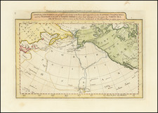
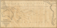
Detailed map of the Pacific, showing continental coastlines, islands, and trade winds. Routes of various noteworthy voyages, including the Royal Prussian Seehandlungsgesellschaft, are shown, along with sea routes, such as the Great Eastern Passage to China, and their estimated travel times.
Condition Description
Closed tear in bottom margin to left of centerfield. Minor foxing.
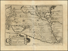
![Pascaart vertoonende de zeecusten van Chili, Peru, Hispania Nova, Nova Granada, en California…. [Early New Zealand Inset]](https://storage.googleapis.com/raremaps/img/small/65168.jpg)