|
||

|

|
|

|
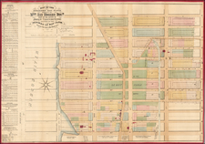
This fascinating historical town plan, published by Townsend Mac Coun in 1909, provides an accurate depiction of New York during its English colonial phase. With specific locations marked in red to highlight principal points of interest, this map includes prominent landmarks such as Trinity Church, Fort George, and Maiden Lane. Based on the famous James Lyne survey, the map's foundation lies in established cartographic research.
During the early 18th century, New York was a growing city within the English colonies of North America. Its strategic position, linking Europe and the American continent, made it a center for trade, governance, and settlement. This map captures New York during this significant period, showcasing its transformation from its Dutch roots to its English identity. The presence of landmarks like the Old Dutch Church, contrasted with the New Dutch Church, as well as the naming distinction of "Bowling Green" post-1732, indicate the city's changing landscape. The map also notes, at Wall Street, the "Slave Market after 1731".
Furthermore, the map sheds light on the diverse cultural fabric of New York. The inclusion of the Quaker Meeting, Lutheran Church, Jews Synagogue, and the French Church, among other sites, points to a multifaceted community. Mac Coun's map, therefore, offers a nuanced view of New York during a period of considerable transition. In many ways it is superior to the facsimiles of the Lyne survey that have been published in the centuries since it was first made, especially in the sense that it is an attempt to render the information on that map in a more geographically accurate format.
![(Second World War -- Navy Day -- Aircraft Carriers) New York City Navy Day 1945 [Panorama of Manhattan's West Side from Across the Hudson]](https://storage.googleapis.com/raremaps/img/small/95396.jpg)
![[Gustave Eiffel's Drawings and Blueprints for the Statue of Liberty]](https://storage.googleapis.com/raremaps/img/small/58964.jpg)