|
||

|

|
|

|
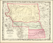
Scarce late double page version of OW Gray's map of Nebraska,which has not been significantly enlarged from its earlier editions. Detailed antique map of Nebraska, colored by counties and showing townships, roads, railroads, towns, etc.
The map shows Sioux County (1877), but pre-dates the 1881 annexation by Nebraska of a portion of what was previously Todd County, Dakota Territory. which would have included the Ponka Reservation and most of the Ponka River watershed and the creation of Brown County and Cherry County in 1883 and Garfield County in 1884.
The map includes detailed treatments of early railroad routes through the state.
O. W. Gray was a publishing firm based in Philadelphia. Later, they published as O. W. Gray & Son. They published atlases in the late nineteenth century. Gray's National Atlas was one of the most successful commercial ventures of the 1870s and one of the last to employ hand coloring on maps.
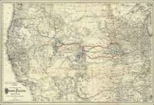
![Military Map of Nebraska and Dakota by Lieut. G.K. Warren . . . [Second state]](https://storage.googleapis.com/raremaps/img/small/95390.jpg)