


|
||

|

|
|

|
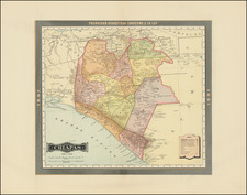
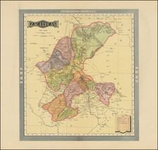
Highly detailed map of Mexico, from a rare early edition of Cram's Standard American Railway Atlas.
The focal point of the map are the railways of Mexico, which are listed and color coded. These include
-
Deming, Sierra Madre & Pacific Railroad: This railroad company served the region of Sierra Madre and provided a crucial connection between the Pacific coast and the town of Deming, New Mexico. It played a key role in transporting goods and people across the region.
-
Hidalgo Railroad: Named after the state of Hidalgo in Mexico, this railroad likely served as a crucial transport link in the area.
-
Interoceanic Railroad: The Interoceanic Railroad of Mexico, constructed in the late 19th century, connected the Gulf of Mexico and the Pacific Ocean—hence the name. Its purpose was to facilitate trade and transport across the country, making it a significant infrastructure project of its time.
-
Merida & Peto Railroad: This railway company served the Yucatan region in Mexico, providing crucial connections between the cities of Merida and Peto.
-
Merida & Progress Railroad: This railway served the Yucatan region as well, connecting the cities of Merida and Progreso, thereby facilitating trade and transport in the area.
-
Merida & Valladolid Railroad: Another key railway line in the Yucatan region, this one connected the cities of Merida and Valladolid, playing a vital role in the region's connectivity and development.
-
Mexican Railroad (also known as Ferrocarriles Nacionales de México): This was the state-owned railroad company that operated the majority of the railway network in Mexico from the late 1930s to 1998.
-
Mexican Central Railroad: The Mexican Central Railroad was a major railway that operated in the central and northern regions of Mexico, providing crucial links for transport and trade.
-
Mexican International Railroad: This railway line was significant for international trade and transport, as it connected several key locations within Mexico with international borders.
-
Mexican Interoceanic Railroad: Like the Interoceanic Railroad, the Mexican Interoceanic Railroad was a key infrastructure development, facilitating coast-to-coast transport and trade across Mexico.
-
Mexican National Railroad: This was one of the primary railways in Mexico and played a pivotal role in the country's transport and communication networks.
-
Mexican Southern Railroad: The Mexican Southern Railroad served the southern regions of Mexico, providing crucial transport links within this area.
-
Michoacan & Pacific Railroad: This railroad served the Michoacán region and provided a connection to the Pacific coast, facilitating local transport and trade.
-
Monterey & Mexican Gulf Railroad: This railroad connected the city of Monterrey with the Gulf of Mexico, playing a vital role in transport and trade in the region.
-
Peninsular Railroad: Named after the Mexican Peninsula, this railroad likely served the peninsula region, but specific historical details about this company are elusive.
-
Puebla and Izucar de Matamoras Railroad: This railway connected the cities of Puebla and Izucar de Matamoras, thereby facilitating transport and development in the region.
-
Sinaloa & Durango Railroad: This railway served the states of Sinaloa and Durango, connecting various cities and towns within these areas and playing a significant role in regional transport.
-
Sonora Railroad: This railway operated in the state of Sonora, providing crucial links for trade and transport.
-
Tehuacan & Esperanza Railroad: This railroad connected the cities of Tehuacan and Esperanza, playing a vital role in transport and communication within this region.
-
Vanegas, Cedral & Rio Verde Railroad: This railway connected the towns of Vanegas, Cedral, and Rio Verde, thereby serving a crucial role in local transportation and trade.
-
Vera Cruz, Anton Lizardo and Alvarado Railroad: This railway connected the port city of Veracruz with Anton Lizardo and Alvarado, facilitating transport and trade along the Mexican Gulf Coast.
Oscar Hinrichs was born on May 4, 1839, in Stettin, Prussia. He was highly educated, studying at the renowned Berlin Polytechnic Institute. In 1858, he moved to the United States and began working in the field of cartography. His talents quickly caught the attention of the military leadership, and when the Civil War broke out, he joined the Confederate Army.
He served as a cartographer and engineer under General Thomas "Stonewall" Jackson, one of the best-known Confederate generals of the Civil War. Hinrichs's primary role was creating detailed maps for military operations. His expertise allowed Jackson to navigate the Virginia landscape effectively, which played a significant role in many of Jackson's successes in battle.
After the war, Hinrichs settled in Baltimore, where he worked as a civil engineer and continued his cartographic work. His maps from the Civil War era are still considered some of the most accurate and detailed of that period.
George F. Cram (1842-1928), or George Franklin Cram, was an American mapmaker and businessman. During the Civil War, Cram served under General William Tecumseh Sherman and participated in his March to the Sea. His letters of that time are now important sources for historians of the Civil War. In 1867, Cram and his uncle, Rufus Blanchard, began the company known by their names in Evanston, Illinois.
Two years later, Cram became sole proprietor and the company was henceforth known as George F. Cram Co. Specializing in atlases, Cram was one of the first American companies to publish a world atlas. One of their most famous products was the Unrivaled Atlas of the World, in print from the 1880s to the 1950s.
Cram died in 1928, seven years after he had merged the business with that of a customer, E.A. Peterson. The new company still bore Cram’s name. Four years later, the Cram Company began to make globes, a branch of the business that would continue until 2012, when the company ceased to operate. For the final several decades of the company’s existence it was controlled by the Douthit family, who sold it just before the company was shuttered.
![[Sketch of Río Chacalapa and surrounding hills]](https://storage.googleapis.com/raremaps/img/small/49303ba.jpg)
![[ Hernando Cortés ] Map of Tabasco Showing the route followed by Hernando Cortés during 1524-5](https://storage.googleapis.com/raremaps/img/small/100145.jpg)
![(Mexican-Aztec Paintings) [Chapultepec and Coyotepec] Mexican Painting. 3738. Codex Vaticanus, page 130, Aglio 2 Vol.](https://storage.googleapis.com/raremaps/img/small/102306.jpg)