|
||

|

|
|

|
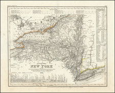
Hempstead Harbor, Long Island, derived from a trigonometrical survey under the auspices of F.R. Hassler and A.D. Bache, the superintendents of the Survey of the Coast of the United States, offers an intricate view of the harbor as it was perceived in the mid-19th century. Triangulated by E. Blunt and detailed in topography by F.H. Gerdes, this map, published in 1859, stands as a testament to the detailed coastal surveys of the United States, emphasizing the importance of maritime navigation and coastal development during this era.
The mid-19th century marked an era of profound maritime surveying and advancement in the United States. With the nation's territorial expansion and increased trade, the accuracy and precision of coastal maps became indispensable for navigation and military activities. Hempstead Harbor, situated on the north shore of Long Island, became an important part of the Long Island Sound's network, serving as both a shelter for ships and a hub of regional maritime commerce.
The detailed work on this map is evident in its hydrographic survey led by T.B. Huger, which provides valuable insights into the depth and topography of the harbor. Notably, the depth soundings, differentiated by feet and fathoms, illustrate the harbor's complex underwater terrain, guiding vessels in avoiding shallow or hazardous areas. Moreover, the notations, such as markings for the nature of the sea bottom like "Sand" and "Rock awash at Low water," play a pivotal role in understanding the harbor's physical characteristics, rendering the map an indispensable tool for mariners.
Hempstead Harbor, Long Island is a product of dedicated collaboration over years, with triangulation efforts spanning 1834-1836 and topographical and hydrographic surveys carried out in 1837 and 1859, respectively. These chronological annotations not only underscore the comprehensive nature of the survey but also exemplify the meticulous efforts that went into capturing the geographical essence of the harbor, making it a significant representation of mid-19th century American coastal cartography.
![A New and Exact Map of the Dominions of the King of Great Britain on ye Continent of North America . . . [Beaver map]](https://storage.googleapis.com/raremaps/img/small/101277.jpg)
![[Niagara Falls] Wasserfall von Niagra](https://storage.googleapis.com/raremaps/img/small/69038.jpg)