


|
||

|

|
|

|
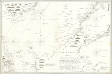
Plan of the Port of Subec, in the Isle of Luconia, surveyed in 1766 and published in London by Laurie & Whittle on 12 May 1794, offers an intricate mapping of Subic Bay located on the west side of Luzon Island. It is noteworthy for its elaborate representation of underwater topography, exhibiting a variety of seabed conditions including mud, sand, pebbles, and shells.
The map hails from a time when European exploration and maritime trade in the Asia-Pacific region was expanding rapidly. Notably, this period was marked by burgeoning British naval power, soon to challenge the dominant Spanish and Dutch presence in Southeast Asia. The Port of Subic, situated in the strategic location of Luzon (then a primary nexus of the Spanish colonial Philippines), would have been a significant point of interest for maritime navigators and merchants.
The survey from which this map is drawn was conducted by Jean-Baptiste d'Après de Mannevillette, a renowned French hydrographer of the 18th century. Mannevillette's commitment to precision and his innovative methods greatly improved the safety and efficacy of sea travel during this period. His influence is apparent in the detailed notes on the composition of the seabed in the port of Subic, offering crucial information for seafarers.
The orientation of the map, with the town of Subec and the north at the top, suggests the cartographic conventions of the era. In the 18th century, it was common for navigational charts to prioritize the representation of harbors, sea routes, and related maritime features. This focus reflects the significance of sea travel and maritime trade in this period of increasing global interaction.
Finally, the wide range of seabed conditions — mud, sand, pebbles, shells — speaks to the diverse underwater topography of Subic Bay. Such data, while seemingly trivial, would have been vitally important for ships anchoring and navigating within the harbor. Understanding the seabed's nature could prevent damage to vessels and ensure safer maritime operations.
In sum, the Plan of the Port of Subec, in the Isle of Luconia offers a rich, precise, and detailed snapshot of 18th-century maritime cartography at a time of burgeoning European exploration and trade in the Asia-Pacific region. It encapsulates a moment when the seafaring world was ever-expanding, and the need for accurate, detailed charts was vital.
Robert Laurie (ca. 1755-1836) and James Whittle (1757-1818) formed their Fleet Street, London-based firm upon the 1794 death of their employer Robert Sayer, himself one of the dominant print and mapmakers of the last half of the 18th century.
Laurie & Whittle started managing Sayer's business as early as 1787. They took over all managerial duties when Sayer's health flagged in 1792, and they changed the imprint in 1794 upon his death. Sayer left the two a 21-year lease on the shop (at £100 a year) and on Sayer's Bolt Court premises, as well as an option to acquire stock and equipment at a preferential price of £5,000 payable over three years.
Robert Laurie retired from the firm in 1812, and his role was assumed by his son, Richard Holmes Laurie (1777-1858). The younger Laurie worked with James Whittle until the latter died in 1818. After R. H. Laurie died in 1858, Alexander George Findlay, FRGS (1812-1875) purchased the firm from his daughters. The firm continues today under another name, specializing in yachting charts.
Laurie & Whittle were prolific print and map publishers, and throughout their careers, they produced numerous very important and rare works. They carried on Robert Sayer's atlas business and were responsible for editions of The Complete East-India Pilot and The American Atlas.
![[Southeast Asia, Philippines & India] Nova Delineatio particularis Apostolicarum Peregrinationum noni Indiarum Apostoli in India Orientali](https://storage.googleapis.com/raremaps/img/small/51679.jpg)
![[Philippine Islands] Carte du Canal des Iles Philippines Par leque passe le Galion de Manille. Et les Iles voisines de ce canal / Kaart van het Kanaal in de Filippynsche Eilanden . . .](https://storage.googleapis.com/raremaps/img/small/76427.jpg)

![[Philippine Islands, Taiwan, etc] Partie des Isles Philippines; Partie de la Chine; Partie de L'Ile Gilolo; Partie de L'Isle Borneo](https://storage.googleapis.com/raremaps/img/small/93579.jpg)