|
||

|

|
|

|
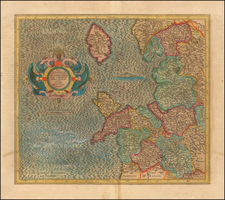
Fine original antique map of the county of Somerset, in southwestern England, with great detail.
The map shows cities and towns, with relief shown pictorially. The caves near Wokey Hole, in the east, are represented in an unusual way, of the sort that does not usually appear on maps. Walled gardens appear, as usual on British county maps. The cities of Taunton, Bath, Minehead, and Bristol (just outside the county) all appear.
The map is surrounded by decorative elements, including two cartouches below the map. Seven coats of arms appear in the upper left, including a blank one for the Earl of Bath.
This map was first published in the middle of the 17th century by Jan Jansson, and was re-issued by Valk and Schenk around 1690. This is the latter edition, identifiable by the Valk and Schenk imprint appearing in the lower right.
![[ London to Dorchester and Bensington ] The Road from London to St. David's com Pembroke . . .](https://storage.googleapis.com/raremaps/img/small/100748.jpg)
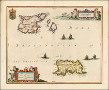
![[ Wight ] Isle de Wigh](https://storage.googleapis.com/raremaps/img/small/98047.jpg)