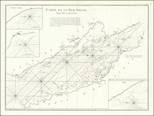
|
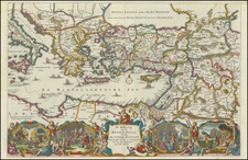
||

|

|
|

|
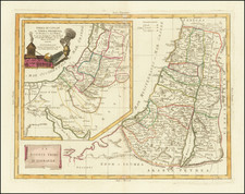
New Map of Palestine Showing the Proposed U.N. Boundaries of Israel; Jewish and Arab Towns, published by The Jewish Chronicle in London in 1948, reflects the geopolitical tensions and transitions in Palestine during the late 1940s. With cartography by Alexander Gross, F.R.G.S., this map captures not just the geographical details of the region but also the pulsating dynamics of the nascent state of Israel and the surrounding Arab territories.
The late 1940s was a pivotal moment in Middle Eastern history. Following the horrors of the Second World War and the Holocaust, there was a significant push for the establishment of a Jewish homeland in Palestine. Concurrently, the Arab populations and their leadership were apprehensive and resistant to these changes, leading to heightened political discussions at international platforms like the United Nations. The demarcation of the proposed U.N. boundaries as illustrated in this map encapsulates these larger dialogues and the quest for a two-state solution, emphasizing the importance of such a cartographic document in the annals of history.
Beyond merely marking the territory, it sheds light on the network of railways, roads, and essential urban centers. The clear differentiation between Jewish settlements and Arab towns and villages offers a vivid snapshot of the demographic landscape of Palestine during this transformative period. Additionally, the map's incorporation of both metric and imperial units exemplifies the intended reach to a global audience, considering the international significance of the Palestinian issue.
![[Poster] Keep the Promise The Israel Emergency Fund](https://storage.googleapis.com/raremaps/img/small/78786.jpg)