|
||

|

|
|

|
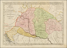
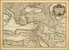
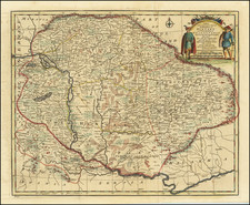
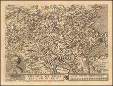
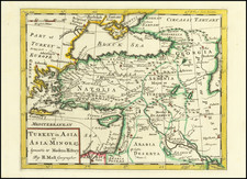
Herman Moll's 1729 A General MAP of TURKY in Europe, Hungary &c. provides a detailed view of Southeastern Europe, a region of geopolitical significance during the 18th century. The map, with engraved inset views of Belgrade and Temeswar, presents a comprehensive visual record of the expansive Ottoman Empire in Europe and its interactions with neighboring territories.
The period during which this map was created was one of considerable turmoil and change in Southeastern Europe. The Ottoman Empire was in decline, and its European territories were increasingly contested by the Habsburg Monarchy and the emergent Russian Empire. Moll's map reflects the shifting power dynamics of the region, with markers indicating where significant battles had taken place, providing a geographical context to these historical events.
The map's annotations offer key insights into the military history of the region. They record critical battles such as Zenta (1697) and Peterwardein (1716), where Prince Eugene of Savoy defeated the Turks, alongside the victories of Prince Louis of Baden in 1691 and the Elector of Bavaria in 1688. The map also notes sites of earlier conflicts, such as Sigismund, King of Hungary's defeat by the Turks at Semendria in 1409, and John Hunyadi's notable victories against the Ottomans in the mid-15th century.
This map not only charts the territories but also attempts to measure the extent of the Ottoman Empire in Europe. The commentary at the bottom of the map notes the empire's greatest length and breadth, further testifying to its considerable size and influence during the period. However, it also acknowledges the contraction of the empire due to the conquests of the Habsburg Emperor, suggesting the fluidity of borders and the dynamic nature of the political landscape.
In conclusion, A General MAP of TURKY in Europe, Hungary &c. is a richly informative cartographic artifact that encapsulates the geopolitical intricacies of Southeastern Europe in the 18th century. It stands as a testament to Moll's approach to cartography and his commitment to providing a comprehensive understanding of the territories he mapped.
Herman Moll (c. 1654-1732) was one of the most important London mapmakers in the first half of the eighteenth century. Moll was probably born in Bremen, Germany, around 1654. He moved to London to escape the Scanian Wars. His earliest work was as an engraver for Moses Pitt on the production of the English Atlas, a failed work which landed Pitt in debtor's prison. Moll also engraved for Sir Jonas Moore, Grenville Collins, John Adair, and the Seller & Price firm. He published his first original maps in the early 1680s and had set up his own shop by the 1690s.
Moll's work quickly helped him become a member of a group which congregated at Jonathan's Coffee House at Number 20 Exchange Alley, Cornhill, where speculators met to trade stock. Moll's circle included the scientist Robert Hooke, the archaeologist William Stuckley, the authors Jonathan Swift and Daniel Defoe, and the intellectually-gifted pirates William Dampier, Woodes Rogers and William Hacke. From these contacts, Moll gained a great deal of privileged information that was included in his maps.
Over the course of his career, he published dozens of geographies, atlases, and histories, not to mention numerous sheet maps. His most famous works are Atlas Geographus, a monthly magazine that ran from 1708 to 1717, and The World Described (1715-54). He also frequently made maps for books, including those of Dampier’s publications and Swift’s Gulliver’s Travels. Moll died in 1732. It is likely that his plates passed to another contemporary, Thomas Bowles, after this death.
![The Severn or Channel of Bristol [with a chart of the Irish Sea.]](https://storage.googleapis.com/raremaps/img/small/47485.jpg)