|
||

|

|
|

|
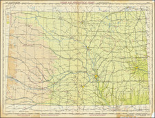
The United States at War, a color map crafted by Stanley F. Turner and published by C.C. Peterson in Toronto, Ontario, in 1943, is a compelling portrayal of the U.S. during World War II. Displayed through Mercator's projection, the map showcases international and state boundaries, capitals, major cities, landmarks, state flags and flowers, airfields, and naval stations, and includes an inset of "The ocean fronts," along with vignette illustrations depicting war events involving U.S. armed forces and a decorative compass rose. Relief is shown pictorially, and the map also features a legend and a chart providing statistics on the Army and Navy.
Amidst the grim era of World War II, maps like The United States at War served as significant informational tools and artistic expressions. They communicated not only geographical details but also the strategic, social, and political complexities of a nation engaged in a global conflict. The inclusion of details like airfields and naval stations reflects the military significance, while vignettes of war events reveal the narrative aspect of the conflict, uniting the home front with the battlefields.
The map offers a unique blend of visual aesthetics and utilitarian information. The use of color, pictorial relief, and decorative elements elevates it from a mere geographical reference to a work of art that encapsulates the national spirit and effort during a critical period. The inset of "The ocean fronts" highlights the global scope of the war, connecting the domestic landscape with the broader international theater.
As an artifact, The United States at War transcends its time, offering historians, geographers, and cultural scholars an intricate perspective on World War II America. Through the synthesis of geography, art, and information, it illustrates not only the territorial extent but also the multifaceted nature of a nation at war. The map stands as a vivid testament to a period of profound change, conflict, and unity, reflecting both the physical landscape and the broader cultural currents of the era.
![(Second World War - Okinawa) [Large Battlefield Composite Map of Okinawa]](https://storage.googleapis.com/raremaps/img/small/63896.jpg)