|
||

|

|
|

|
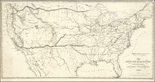
The "Industrial Map of the United States and New Possessions" by The Fort Dearborn Pub. Co., copyrighted in 1901 by John F. Waite, offers an informative and visually appealing representation of the United States and its territories, highlighting time zones, population, size, primary economic goods, and more.
The map features red overprinting on each state to emphasize essential demographic and economic data, providing a snapshot of the nation's industrial landscape at the turn of the 20th century. Insets of U.S. territories, including the Philippines, further extend the map's geographical scope, offering a comprehensive view of the country and its global possessions.
An additional inset map traces the growth of the United States through instances of territorial acquisitions, such as the Mexican Cession of 1848. This feature offers valuable historical context and helps to illustrate the nation's expansion over time.
On the reverse side of the folding map, extensive tables detail railroad distances and other relevant transportation information, underscoring the importance of infrastructure in connecting and sustaining the country's industrial and economic development.
In summary, the "Industrial Map of the United States and New Possessions" is a rich and informative resource that captures the United States' industrial landscape and territorial growth in the early 20th century. Its combination of geographical detail, economic data, and historical context makes it an attractive piece for collectors, historians, and enthusiasts interested in the nation's industrial and territorial development.