This item has been sold, but you can enter your email address to be notified if another example becomes available.


|
||

|

|
|

|
Stock# 92534
Description
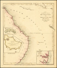
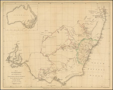
Colonial-era map of Australia and Oceania showing the area from Sumatra east to the Pitcairns and from Nagasaki south to Bishop and Clerk Islands, encompassing Hawaii.
Two inset maps show Tasmania and New South Wales, the latter with county divisions, including the original nineteen, Hawes, and Macquarie.
Condition Description
Very light, minimal foxing. Slight discoloration along vertical fold lines. Flattened.
![[Australia] Ins kleine Gebrachte Karte von den Sud-Laendern Zur Historie der Reisen](https://storage.googleapis.com/raremaps/img/small/93880.jpg)