|
||

|

|
|

|
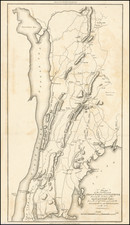
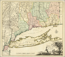
This antique map of Huntington, Suffolk County, New York, published by Fredrick W. Beers in New York in 1873, is a detailed and comprehensive representation of the town at the time of its creation. The map features insets of Centreport, Vernon Valley, and North Babylon, as well as the coastal points of Lloyd's Neck and Eatons Neck.
The map is hand-colored by district. Furthermore, civic, residential, and commercial buildings are illustrated on the map. The map also lists the names of many landowners, providing a valuable historical record of property ownership in the town.
Overall, the map is an excellent example of 19th-century cartographic techniques, offering a rich and detailed depiction of Huntington during a significant period in its history.