|
||

|

|
|

|
Detailed map of a large tract of land in Davie County, North Carolina, between Dutchman Creek and Elisha Creek, just east of Mocksville, North Carolina.
The map locates a dwelling, which is likely the home of Robert Sprouse, who arrived in the Mocksville area an 1855.
The map shows the road leading to Mocksville, a dwelling at the center of the property, a parcel of the land sold off to J. ? Woodruff, and a number of other natural and man made points of reference relating to the survey.
The map transcribes as follows:
The above plat represents a tract of Land Surveyed for Robt. Sprouse in the County of Davie, on Dutchman Creek, embracing the mouth of Buffalo Creek, & adjacent to Lashes [Elisha] Creek, (originally owned by Ephraim Gaither) . . . .
Robert Sprouse is likely the Robert Sprouse who was a Whig politician, doctor, and farmer, who opposed secession. He was born in Virginia in 1810, and died in June 1867. Sprouse originally settled in Yadkin County, before moving to the Mocksville area in 1855, where he was a farmer and later Special County Magistrate.
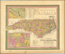
Mocksville, North Carolina
In the late 1740’s, settlers began migrating to the area west of the Yadkin River. In 1836, Davie County was formed from a portion of Rowan County, named for William R. Davie, a Revolutionary War Leader, governor of North Carolina, minister to France and a leader in the founding of the University of North Carolina.
A small village named “Mocks Old Field” was in existence before the American Revolution. Mocks Old Field was used frequently as a secret meeting place for Colonial forces and planners, some of whom were members of the family of Davie County’s most famous citizen, Daniel Boone.
Mocksville was incorporated in 1839.
![[Carolina]](https://storage.googleapis.com/raremaps/img/small/89687.jpg)

![North and South Carolina [with plan of Charleston]](https://storage.googleapis.com/raremaps/img/small/103044.jpg)