|
||

|

|
|

|
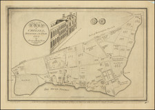
The London Transport Trolleybus & Tram Map of Routes, published in 1947 by Waterlow & Sons Limited and Fred. J. H. Elston, serves as a detailed guide to London's trolleybus and tram routes during the post-war period. Elaborating both daily and special journey operations, including weekend and night services, it provides valuable insights into the complexities of the city's public transportation system at a time of reconstruction and reorganization.
The end of the Second World War in 1945 marked the beginning of London's rebuilding and revitalization. A crucial aspect of this process was the re-establishment and expansion of public transportation, particularly trolleybuses and trams, to connect the rapidly healing city. This map illustrates the intricate web of routes available to the citizens of London, with red figures indicating Saturday and Sunday operations and blue figures for night operations. The designation of terminal points and underground stations further enhances the understanding of the city's transportation framework.
The map's division into various categories, such as daily services, weekdays only, and all-night routes, showcases the diversity of London's transportation system. The specification of Sunday-only and special journey routes reflects the attempt to cater to different commuter needs and societal demands. At the same time, the map's mention that information is subject to revision without notice underscores the fluid nature of the transportation network, adapting to the dynamic urban landscape of post-war London.
Ultimately, the London Transport Trolleybus & Tram Map of Routes is more than a mere cartographic representation; it is a historical document that captures a specific moment in London's history. It offers a glimpse into the daily life and urban planning of a city recovering from devastation, focusing on rebuilding and reconnection. By detailing the intricate design of London's public transportation network, the map stands as a testament to the resilience and ingenuity of a city determined to thrive once more.
![[View of London, etc.] Abilltung wie königliche Maistät in Engelandt Die Artickel Dess Spanischen Heyraths Jur: Bekreftiget Anno 1623](https://storage.googleapis.com/raremaps/img/small/90777.jpg)
![[London / Tower of London ] La tour de Londres](https://storage.googleapis.com/raremaps/img/small/101674.jpg)