


|
||

|

|
|

|
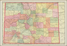
Interesting late 19th Century map of the area around Denver, focused on the many outlining subdivisions then under construction or otherwise planned.
The map is centered Cherry Creek and the intersection of Broadway and Alameda. The printing style, white lines on a black background, is also quite unusual.
The map focuses on the suburban growth around Denver. In addition to the city of Denver, the map shows the surrounding region, including nearby towns and cities, as well as natural features such as rivers, lakes, and mountains.
In the last two decades of the 19th century, Denver experienced rapid growth and development. The city was founded in 1858, and by the 1880s, it had become an important regional center for trade, commerce, and transportation.
One of the key factors driving Denver's growth in the late 19th century was the expansion of the railroads. In the 1870s, a number of railroads were built to connect Denver to other cities in the region, including Chicago, Kansas City, and San Francisco. These railroads brought new people, goods, and ideas to Denver, and they helped to make the city a more important hub for trade and commerce. Another factor contributing to Denver's growth was the discovery of gold and other minerals in the surrounding region. By the end of the 19th century, Denver had grown to a commercial hub driving by the numerous mining booms in the preceding decades.
Rarity
The map is apparently very rare. OCLC locates a single example (History Colorado).
This is the first time we have ever seen the map.
We were unable to locate any other examples at auction or in dealers records.
![[Leadville / Alma District] London Mountain Gold Mining Company](https://storage.googleapis.com/raremaps/img/small/69724.jpg)
![[ Colorado ]](https://storage.googleapis.com/raremaps/img/small/88749.jpg)