|
||

|

|
|

|
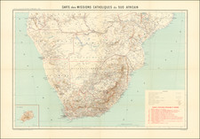
In Philips' Detailed Map of the Transvaal with Part of the Orange River Colony, George Philip & Son, Ltd, London Geographical Institute, offers a comprehensive visualization of the Transvaal region and part of the Orange River Colony as they were circa 1900. Rendered with precision and depth, the map encapsulates the intricate geography, transportation networks, and colonial boundaries of Southern Africa at the turn of the 20th century.
At this time, the Transvaal region was at the heart of significant political and social upheaval due to the South African War (or Second Boer War) from 1899 to 1902. The map's meticulous depiction of railways, frontiers, and roads within the Transvaal and part of the Orange River Colony provides a window into the infrastructural and geopolitical realities of the region during this tumultuous period.
Of particular interest is the map's delineation of bordering regions such as Portuguese East Africa, Natal, the Orange River Colony, and the Bechuanaland Protectorate. This comprehensive coverage underscores the complex political landscape of Southern Africa during the colonial era, as the map captures not just the physical geography but the vestiges of colonial power imprinted upon the land.
Released as a color-printed folding map, the Philips' Detailed Map of the Transvaal with Part of the Orange River Colony reflects the precision and reliability synonymous with the work of G. Philip & Son, Ltd, London Geographical Institute. The map, preserved with its original cover bearing the title, offers an informative and significant perspective on Southern Africa's historical topography during a critical epoch of its past. This detailed cartographic document embodies both the meticulous craft of its creators and the intricate historical narrative of the region it depicts.
![Juta's Map of South Africa From The Cape To The Zambesi Compiled from the best available Colonial and Imperial Information Including The Official Cape Colony Map By The Surveyor General, Cape Town, Dr. T.Hahn's Damaraland, And E.C.Selous' Journals & Sketches &c. New and Revised Edition .. . . 1889 [2 Sheets in slipcase]](https://storage.googleapis.com/raremaps/img/small/85389.jpg)