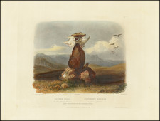
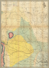
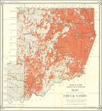
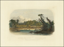
Scarce map of Idaho, Montana & Wyoming from a late edition of Colton's Atlas. This is one of the last maps added by Colton. It shows a wonderful 7 county Wyoming, 12 county Montana and 13 county Idaho. The state surveys are just beginning in each of the 3 territories. Yellowstone is shwon and the neighboring area is relatively well mapped, however most of Wyoming and Montana is still argely unknown. Shows towns, rivers, railroads, stations, post offices, forts, Indian Reserations, mountain passes and many other early details. An excellent collector's map, rarely available on the market. Minor fold split and narrow top and bottom margins, as issued.
G. W. & C. B. Colton was a prominent family firm of mapmakers who were leaders in the American map trade in the nineteenth century. The business was founded by Joseph Hutchins Colton (1800-1893) who bought copyrights to existing maps and oversaw their production. By the 1850s, their output had expanded to include original maps, guidebooks, atlases, and railroad maps. Joseph was succeeded by his sons, George Woolworth (1827-1901) and Charles B. Colton (1831-1916). The firm was renamed G. W. & C. B. Colton as a result. George is thought responsible for their best-known work, the General Atlas, originally published under that title in 1857. In 1898, the brothers merged their business and the firm became Colton, Ohman, & Co., which operated until 1901, when August R. Ohman took on the business alone and dropped the Colton name.