|
||

|

|
|

|
Stock# 85151
Description
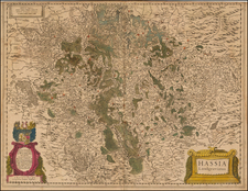
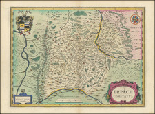
Fine original antique regional map of northern Germany, published at the start of the 18th century. The map shows the region north of Erfurt and Weimar in central Germany.
The map shows a number of cities in the region in detail and includes a number of other fascinating features, such as forests, mountains, rivers, and more. The map shows a number of crisscrossing rivers in this flat and partially dredged portion of the country. Hanover, Leipzig, and Brunswick appear.
The region was, at the time, part of the Holy Roman Empire, which was slowly turning into the Prussian Empire.
Condition Description
Original hand-color, in outline. Nice wide margins.