|
||

|

|
|

|
Rare Spanish Map of St. Kitts
Rare separately issued chart of St. Kitts, published by Juan Lopez, one of the most prolific mapmakers during the Spanish Enlightenment period at the end of the 18th Century.
The map is drawn from Samuel Baker's monumental 4-sheet map of St. Kitts, based upon his surveys in 1753.
Lopez's map depicts the island divided into its parishes (quartels), and contains a wealth of early information relating to houses, churches, forts, sugar mills, and individual properties The map is also noteworthy for the level of its inland detail. Beyond the island's capital, Basseterre Town, located at the lower center of the image, the map plots individual houses and plantations, and identifies the house of the Governor
At the time this map was produced, St. Christopher was on the way to becoming one of Great Britain's most important sugar- producing colonies in the Caribbean. By the advent of the American Revolution, the island was the richest territory per capita in the Empire. This rise to prosperity and importance explains the lavish size and detail of the map.
Includes excellent detail, both coastal and topographical, along with an extensive note regarding the island.
Rarity
Lopez's maps rarely appear on the market.
Tomás López de Vargas Machuca (1730-1802) was one of Spain’s most prominent cartographers in the eighteenth century. He was born in Toledo but studied at the Colegio Imperial in Madrid, where he focused on mathematics, grammar, and rhetoric. Along with a small group of colleagues, in 1752 the Spanish government sent López for training in Paris with the renowned geographer Jean Baptiste Bourguignon d’Anville. When he returned to Spain he was named Geógrafo de los dominios de Su Magestad and put in charge of the geographic collections of Charles III. He published many maps, including his fascinating maps of the Americas, and a variety of geography manuals. Some of his most famous maps are of the Iberian Peninsula, part of his large project to create a majestic atlas of Spain. Unfinished in his lifetime, López's children published the Atlas Geográfico de España (Geographical Atlas of Spain) in 1804. It was republished in 1810 and 1830.
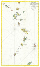
![Martinico [and] Dominica](https://storage.googleapis.com/raremaps/img/small/85250.jpg)
![[ Curacao / Aruba / Bonaire / Venezuela ] Pas-kaart vande zee custen van Venecuela met dye Bylegende Eylanden . . .](https://storage.googleapis.com/raremaps/img/small/99928.jpg)
![A New & Accurate Map of Bermudas or Sommer's Islands [with] An Accurate Map of the Island of St. Christopher, vulgarly called St. Kits . . .](https://storage.googleapis.com/raremaps/img/small/77156.jpg)