|
||

|

|
|

|
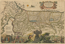
Finely engraved map of the Holy Land, engraved by Baptista Van Deutecum and first published by Petrus Plancius circa 1590.
Remarkable early Dutch Bible depicting the land of Canaan. The map is surrounded by fourteen vignettes containing Biblical scenes, including Samson slaying the Philistines with the jawbone of an ass, David and Goliath, and the golden calf.
Petrus Plancius (1552-1622) was born Pieter Platevoet in Dranouter in West Flanders. He trained as a clergyman in Germany and England, but he was an expert not only in theology but in geography, cosmography, and navigation. After fleeing prosecution by the Inquisition in Brussels, Plancius settled in Amsterdam where he first began his forays into navigation and charting. As Amsterdam was a hub for trade, Plancius was able to access Portuguese charts, the most advanced in the world at that time. Plancius used these charts to become an expert in the sailing routes to India, knowledge that gained him opportunity. Plancius was one of the founders of the VOC, for whom he worked as their geographer. He also served on a Government Committee to review the equipment needed for exploratory expeditions.
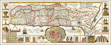
![[ Cyprus, Syria, Palestine, etc. ]](https://storage.googleapis.com/raremaps/img/small/103027.jpg)
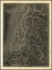
![Asia [with inset:] Palestine or the Holy Land.](https://storage.googleapis.com/raremaps/img/small/93612.jpg)