


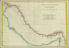
|
||

|

|
|

|
Map showing the extent of Cyrus II of Persia's Achaemenid Empire with French text describing the history. The empire is shown, and described in the upper left, as extending north to the Black Sea and Caspian Sea, west to Hellespont and the Aegean Sea, south to Ethiopia and the Arabian Gulf, and east to the Indus River.
From Buy De Mornas' Atlas methodique et elementaire de geographie et l'histoire
Louis Brion de la Tour (ca. 1743-1803) was a French geographer and demographer. Little is known about Louis’ early life, but some glimpses of his professional life survive. He did achieve the title of Ingénieur Géographe du Roi. Much of his work was done in partnership with Louis Charles Desnos, who was bookseller and geographical engineer for globes to the Danish Crown. He worked on the Indicateur fidèle ou guide des voyageurs, qui enseigne toutes les routes royales between 1762 and 1785. During his career he also worked on several atlases. By 1795, he had gained a pension from the National Assembly. Perhaps this pension was granted in part because his son, also Louis Brion de la Tour (1763-1823), was an engraver who made Revolutionary prints, as well as maps.

![[ Arabia ] Carte Des Trois Arabies Tiree en Partie de l'Arabe de Nubie, en partie de divers autres Autheurs . . . 1654](https://storage.googleapis.com/raremaps/img/small/99810.jpg)
![(Second World War - Oilfields) Vorderasien mit seinen Erdölgebieten [Western Asia with Its Oil Fields]](https://storage.googleapis.com/raremaps/img/small/87373.jpg)