|
||

|

|
|

|
Ruysch’s World Map—The First Obtainable Printed Depiction of the Americas
A handsome example of Johannes Ruysch's map of the world, recognized as the oldest obtainable map to shown any part of the Americas.
Ruysch, a Benedictine monk, is documented to have undertaken at least one expedition to the New World between approximately 1497 and 1504, and possibly a second voyage as part of the 1497-98 Cabot Expedition. By 1507, his reputation as a cosmographer, astronomer, and painter had earned him a call to Rome, where he established a friendship with many important figures, including the artist Raphael. Ruysch's career later evolved into roles as a cosmographer and astronomer for the Portuguese Crown.
On his map, Ruysch intriguingly portrays Caribbean islands and a continent-sized landmass, South America, situated amidst a large sea between Africa and Asia. The map stands out as a striking compilation, offering impressively precise representations of the African and South and Southeast Asian coastlines, recently explored by the Portuguese in pursuit trading hubs.
Employing a unique fan-shaped (modified equidistant) conical projection, Ruysch's map integrates the early explorations of the Spanish, English, and predominantly, the Portuguese in the Americas. The map adopts the Portuguese term Terra Sancta Crucis sive Mundus Novus for South America, while the explored areas of North America (Terra Nova, etc.) and Greenland appear connected to the Asian continent, aligning with the theories proposed by Christopher Columbus and reflecting the ongoing geographical debates on how to incorporate the Americas into the existing European worldview.
The Arctic is depicted with four large islands in the Polar Sea, marking the first meaningful attempt to portray these regions on a printed map, reminiscent of the Arctic on the Behaim globe (1492). This four-island illustration would later be adopted by Gerard Mercator and others for the next two centuries. The concept for this arrangement originates from De Inventio Fortuna, as Ruysch notes on the map, which also refers to magnetic variation and the concept of a magnetic pole (or magnetic mountain), a novel inclusion.
India, Southern and Eastern Asia, and Africa's depiction are significantly modernized compared to Ptolemy's maps. This is the first printed map to provide a more accurate orientation for Africa's northern coast, drawing from earlier portolan charts. It downsizes the Mediterranean, which Ptolemy had overstated, and it also becomes the first to exclude the Ptolemaic eastern extension to Scotland.
Ruysch employs the most recent toponyms, listing more place names in the Indian subcontinent than on the Contarini-Ruscelli map (1506). He disapproves of Ptolemy's concept of the Indian Ocean as an inland sea, noting, "Ptolemy said that this Indian sea with all its bays was totally enclosed by land, but recent Portuguese voyages have demonstrated that it is part of the ocean.”
Ruysch depicts Madagascar and Sri Lanka with restraint compared to some of his contemporaries. In the southeast of the Indian Ocean, there's a large island labeled Taprobana. Taprobana, initially the Greek name for Sri Lanka, was also used by late-medieval and early modern geographers for Sumatra and various phantom islands in the Indian Ocean. Here, it is used for Sumatra, which is also represented as Java Minor.
Confusion often resulted from merchants' reticence about the location of many islands. Both Sri Lanka and Sumatra were rich in resources, particularly spices, and those with access to these resources were reluctant to share. There were also many European rumors about the island. The author of The Travels of Sir John Mandeville claimed that Taprobana was part of Prester John's kingdom and that the island had gold mountains guarded by man-eating ants. The author also claimed that the island was home to the Sciapodes, or men with only one large foot, a detail borrowed from Greek sources.
Ruysch adds a note mentioning that the island is home to elephants and tigers and refers to a recent Portuguese expedition to the area in 1507. This is a misinterpretation of the Portuguese contact with Sri Lanka in 1505. However, it also underscores the map's contemporary sources and their primary origin: Portugal.
Several details, such as Africa's shape and the mention of the cod fishery near Newfoundland (one of the earliest instances of the word bacalao on a printed map), suggest Ruysch had privileged access to Portuguese sources for the most recent voyage information. It is also probable that Ruysch had access to or was aware of earlier maps such as the Fra Mauro map (1459), the Martellus map (circa 1490), and the Behaim globe (1492).
The title cartouche runs along the top border. On the side of the projection, on the eastern edge, are seven climates, with two more incompletely erased from the plate, leaving ghostly imprints on the print. Greek thinkers hypothesized that there were seven distinct climates in the oikumene, or known world, grouped by similar weather and the duration of the longest days at the solstice. Accordingly, along the western edge are parallels describing the length of the longest days at each latitude; near the North Pole, these days last for months.
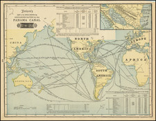
Ruysch's map is pre-dated only by the 1506 Contarini-Roselli world map, which is known to survive in a single example. The Ruysch was published the same year as Waldseemüller’s famous wall map of the world, the first to name America, which is also known in a single example. Rarely available on the market, it is the earliest obtainable map featuring the Americas.
Ruysch’s Atlantic and the Americas
Between Europe, Africa, and Asia, are many details. Framed by the ocean is Antilia Insula. The nearby note explains:
This island of Antilia was discovered by the Portuguese, and now when it is sought it is not found. In this island are people who speak the Spanish tongue, and who in the time of King Roderick are believed to have fled to this island from the barbarians who at that time invaded Spain. Here dwelt an archbishop with six other bishops, each one of whom had his own particular city. Wherefore this island is called by many “seven cities.” This people lived most piously in the full enjoyment of all the riches of this time.
Antilia, or the Island of the Seven Cities, was a mythic island whose story grew from the Muslim conquest of the Iberian Peninsula. Supposedly, seven Christian bishops fled from Muslim forces across the sea, landing at an island they called Antilia. Each bishop set up his own city, covered in gold. The story gained cartographic form with portolan charts in the fourteenth century. The island is included on the Behaim globe and was part of Columbus’ plan for sailing to Asia. The name was adopted for the outlying islands of the Caribbean, but the larger island in the middle of the Atlantic, seen here, faded from maps by the early seventeenth century.
Spagñola and a larger island to the west float unattached to either continent, suggesting a direct maritime passage to the riches of the Orient. To the south is the Mundus Novus, or New World, of South America, with Iberian findings on the eastern and northern coastlines.
Ruysch explains that Spagñola is likely Marco Polo's Spangu (Japan). The second island, to the west, is the partially explored coastline of Cuba, as argued by Donald McGuirk. Close examination of many of the surviving examples suggest that there was a change to the plate. Previously, a smaller island was depicted, labeled De Cuba. This was replaced by the triangular island shown here.
South America reveals Ruysch’s dependence on Portuguese sources, with toponyms from their voyages as far as fifty degrees south. The western coast is obscured by a scroll. It states:
Spanish sailors came as far as this and called this land the New World because of its size, since indeed they did not see it all, nor up to this time have they surveyed further than this limit. Therefore here it is left unfinished, especially since it is not known in which direction it tends.
Production and changes to the plates
Ruysch’s world map was created for a new edition of Ptolemy's Geographia, which had previously been published in Rome in 1478 and 1490, including only a classical Ptolemy World map. With the discovery of the New World, circumnavigation of Africa and significant new information, there was sufficient cause to include a modern world map.
It is likely the Ruysch map was intended for inclusion in the 1507 edition of the Rome Ptolemy Geographia, edited by Evangelista Tosinus and published by Bernard Venetus de Vitalibus. Evangelista Tosinus, a Fench born bookseller who was then active in Rome obtained a privilege to sell the map from Pope Julius II on July 28, 1506. However, the Ruysch map was was apparently not yet ready at the time of the first publication of the 1507 edition, as only some examples of the 1507 edition, include the Ruysch world map, whereas is seems to have been included in the 1508 edition.
States of The Map
The map is made from two plates, one for the west (Americas and part of Asia) and one the east (Europe, Africa, and Asia). Each plate was updated several times during printing, with Swan and Shirley describing five different states of the plates. However, it is better to understand the plates as in flux during their print runs, as sheets from different stages in the changes were paired together, suggesting no consistent chronology of distinct states.
In his Census and Commentary on the map, McGuirk offers a clearer system of labelling the west (left) plate with numbers and the east (right) plate with letters. After a meticulous study involving approximately 64 examples of the map, McGuirk located 3 known states of the left plate and 3 known states of the right plate. The following is a list of the different states of the 2 plates described by McGuirk:
Left Plate
- State 1 - Eastern most island in Caribbean called CANIBALI.
- State 2 - Canibali changed to LA DOMINICA. CANIBALOS IN.. now appears for Trinidad, just above Venezuelan Coast. The letters O C E (part of the larger word OCEANUS) are fanned out along the bottom of the blank ocean, just inside the neatline, at the bottom of the printed image.
- State 3 - PLISACUS SINUS added in large block letters off the coast of China. SINUS GRUENLANTEUS added between Greenland and Newfoundland. (SINUS and GRUENLANTEUS are oriented perpendicular to one another, in order to fit them around pre-existing text.
Right Plate
- State A - Lacking the additions noted below
- State B - AGISMBUS SINUS appears in ocean west of Africa and below the equator. SINUS GAGETCIUS appears below the Bay of Bengal. SINUS MAGNUS appears in the upper right corner, at the mouth of the Daona Fluvius. At the bottom of the image, spread across the ocean above the neat lines, are the letters A N U S (the remaining part of OCEANUS which appeared for the first time in State 2 of the left plate).
- State C - PELAGUS BONE SPERANZE added off the Cape of Good Hope below Africa. SEYLLAN OCEANUS is added to the right of SINUS MAGNUS in the upper right corner.
McGuirk was able to identify 6 different combinations, which he labeled 1-A (3 examples), 1-B (3 examples), 2-B (12 examples), 2-C (1 example), 3-B (1 example), and 3-C (39 examples). Mc Guirk was unable to locate any known examples of 1-C, 2-A or 3-A combination.
The present example is McGuirk's 3-C, the most complete version of Ruysch’s influential world map.
Rarity
All states of the map are rare on the market, with most surviving examples being 3-C, as noted above.
Johannes Ruysch was a Benedictine monk who was also an accomplished painter, astronomer, and cartographer. He was born in ca. 1460 in Utrecht. In either the late 1490s or the early 1500s, he sailed on a ship from Bristol along roughly the 53rd parallel toward Newfoundland. It is possible he sailed on the Cabot expedition of 1497-8 but the precise voyage is unverified. Around 1505, he came to serve in the St. Martin monastery in Cologne, where he studied painting and astronomy; he painted the signs of the zodiac on the walls of the monastery. He was then called to Rome to help with the painting of the papal apartments in the early sixteenth century, where he befriended Raphael. It was while he was in Rome that he was commissioned to create his influential world map of 1507. Afterward he went to serve the Portuguese Crown as an astronomer and cosmographer. He died in 1533 at the St. Martin monastery.
![Mappe-Monde ou Carte Generale du Globe Terrestre, Representee en deux Plan-Hemispheres [World Map or General Map of the Earth, Represented in Two Plan-Hemispheres]](https://storage.googleapis.com/raremaps/img/small/93262.jpg)